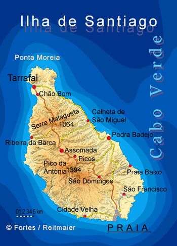
Ponta Moreia
| Ponta Moreia | |
|---|---|
 Ponta Moreia, its location is in the north of the island | |
 Cape Verde | |
| Location | Northern Santiago, Cape Verde |
| Coordinates | 15°20′25″N 23°44′33″W / 15.34016°N 23.74253°WCoordinates: 15°20′25″N 23°44′33″W / 15.34016°N 23.74253°W |
| Offshore water bodies | Atlantic Ocean |
Ponta Moreia is the northernmost point of the island of Santiago, Cape Verde.[1] It is about 2 km north of the nearest village, Fazenda, and around 5 km north of Tarrafal.
There is a lighthouse near the headland, Farol de Ponta Moreia. It is an 8 metres high tower, with a focal plane of 97 meters above sea level.[2][3]
References
- ↑ Cabo Verde, Statistical Yearbook 2015, Instituto Nacional de Estatística, p. 26
- ↑ List of Lights, Pub. 113: The West Coasts of Europe and Africa, the Mediterranean Sea, Black Sea and Azovskoye More (Sea of Azov) (PDF). List of Lights. United States National Geospatial-Intelligence Agency. 2018. p. 427.
- ↑ Rowlett, Russ. "Lighthouses of Cape Verde". The Lighthouse Directory. University of North Carolina at Chapel Hill.
The island of Santiago | ||
|---|---|---|
| Mountains | 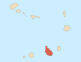 | |
| Streams | ||
| Points and promontories | ||
| Other geographic features | ||
| Transportation | ||
| Other topics | ||
| ||
This article is issued from
Wikipedia.
The text is licensed under Creative Commons - Attribution - Sharealike.
Additional terms may apply for the media files.