Pondoland
| Pondoland | |
|---|---|
| Natural region | |
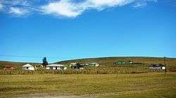 Landscape in Pondoland | |
 Old map of the Eastern Cape, showing Pondoland (highlighted) | |
| Country | South Africa |

Pondoland is a natural region on the South African shores of the Indian Ocean. It is located in the coastal belt of the Eastern Cape province.[1] Its territory is the former Pondo Kingdom and the traditional region of the Pondo people,[2] one of the Xhosa people groups.
Geography
Pondoland stretches between the Mthatha River, whose mouth is its southernmost point, and the Mtamvuna River in the north along a coastal strip that is a maximum of 50 km wide.[3] The Mzimvubu River divides Pondoland into an eastern and a western region.
It is a mountainous area whose main vegetation consists in thornveld, grassland, as well as subtropical evergreen forests in the humid coastal valleys.
History
| The Mpondo people | |
|---|---|
| Person | umMpondo |
| People | amaMpondo |
| Language | isiMpondo |
| Country | Mampodweni |
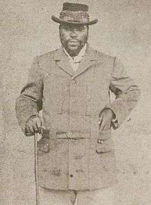
The San and Khoikhoi people had inhabited the region since ancient times in scattered nomadic groups. About 500 AD the Mpondo people settled in the area, for the mountain grasslands were a good resource for cattle-rearing. Geographically Mpondoland was a remote area, not strongly affected by the events in the rest of South Africa. During the centuries of European navigation towards the Indian Ocean, Portuguese ships, as well as ships from other colonial empires(such as the Grosvenor) ran aground at different spots of the coast of Mpondoland. Some of the castaways stayed in Mpondoland and were later absorbed into Mpondo communities. The Mpondo clan of abeLungu traces its ancestry to a castaway English girl named Bessie who married the son of Mpondo Chief Matayi of the amaTshomane.[4]
In 1820, Pondo King Faku granted permission to the Wesleyans to establish a mission within his territory. A few decades later some German settlers came to Pondoland and by 1885 German Lieutenant Emil Nagel tried to establish a German colony, an effort that was unsuccessful. In 1886 the British segregated Xesibeland, traditionally part of the Pondo Kingdom, and armed Pondo people resisted the move by invading the territory, burning kraals and causing disorder.[5] The segregation of Xesibeland was a first step prior to its annexation to the Cape Colony at the end of the same year.[6] Finally Pondoland as well became a British protectorate and in 1894 the Pondos were forced to accept the annexation of their own region to the Cape Colony.[7]
The implementation of Apartheid legislation in the form of the 1951 Bantu Authorities Act led to the Pondo Revolt in 1960. After the quelling of the revolt Pondoland was made part of the Transkei homeland in 1963, which in turn became a nominally-independent bantustan in 1976. Finally the region, along with the other areas that were part of Transkei, was reincorporated into South Africa in 1994.[8]
In recent times the name of this traditional region of the Pondo people is being revived for the Maputaland-Pondoland-Albany Hotspot biodiversity hotspot, the Maputaland-Pondoland bushland and thickets, one of the ecoregions of South Africa, and for the Pondoland Centre of Plant Endemism.[9] It is also found in scientific works, as well as in the naming of species, such as the Pondoland palm (Jubaeopsis caffra), the Pondoland ghost bush (Raspalia trigyna), the Pondoland conebush (Leucadendron pondoense), the Pondoland widow (Dira oxylus) and the Pondoland cannibal snail (Natalina beyrichi).[10]
See also
References
- ↑ Pondoland (region, South Africa) - Britannica Online Encyclopedia
- ↑

- ↑ Contributions to the ecology of Maputaland, Southern Africa
- ↑ Mpondo Kingdom - The History of The Kingdom Archived 2013-07-04 at the Wayback Machine.
- ↑ Charles Eugene Little. Cyclopedia of Classified Dates
- ↑ George Campbell. The British empire
- ↑ Blue-book on Affairs of Pondoland, August 1885
- ↑ Bizana and the Pondoland Revolt 1946 - 1962
- ↑ Ecoregions of South Africa Archived 2011-11-16 at the Wayback Machine.
- ↑ Pondoland cannibal snail (Natalina beyrichi)
Bibliography
- Elephant Coast Visitor Guide, (2007/8).
- Pooley, E. (1993). The Complete Field Guide to Trees of Natal, Zululand and Transkei. ISBN 0 620 17697 0