Plumwood, Ohio
| Plumwood, Ohio | |
|---|---|
| Unincorporated community | |
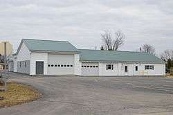 Monroe Township hall | |
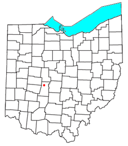 Location of Plumwood, Ohio | |
| Coordinates: 40°00′29″N 83°24′56″W / 40.00806°N 83.41556°WCoordinates: 40°00′29″N 83°24′56″W / 40.00806°N 83.41556°W | |
| Country | United States |
| State | Ohio |
| County | Madison |
| Township | Monroe |
| Elevation | 1,007 ft (307 m) |
| Time zone | UTC-5 (Eastern (EST)) |
| • Summer (DST) | UTC-4 (EDT) |
| GNIS feature ID | 1070904[1] |
Plumwood is a census-designated place in central Monroe Township, Madison County, Ohio, United States.[2] It lies at the intersection of State Route 38 with Arthur Bradley Road, 8½ miles (13½ km) north of the city of London, the county seat of Madison County. The Spring Fork of the Little Darby Creek flows past the community.[3]
Plumwood was originally laid out on December 23, 1895, by Charles F. Sanford. The community was originally named Sanford, but the name was later changed.[4] As of 1915, the community was one of the largest trade posts in the county, with three large general stores, a blacksmith, six threshing outfits, three hay baling outfits, and the population was 200.[4]
References
- ↑ "Plumwood, Ohio". Geographic Names Information System. United States Geological Survey.
- ↑ U.S. Geological Survey Geographic Names Information System: Plumwood, Ohio
- ↑ DeLorme. Ohio Atlas & Gazetteer. 7th ed. Yarmouth: DeLorme, 2004, pp. 57, 67. ISBN 0-89933-281-1.
- 1 2 Bryan, Chester E., History of Madison County, Ohio, B.F. Bowen & Company, Inc., Indianapolis, Indiana, 1915, Pg. 181.
Municipalities and communities of Madison County, Ohio, United States | ||
|---|---|---|
| City | 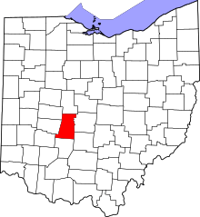 | |
| Villages | ||
| Townships | ||
| CDPs | ||
| Unincorporated communities | ||
| Footnotes | ‡This populated place also has portions in an adjacent county or counties | |
This article is issued from
Wikipedia.
The text is licensed under Creative Commons - Attribution - Sharealike.
Additional terms may apply for the media files.