Pleasant Township, Madison County, Ohio
| Pleasant Township, Madison County, Ohio | |
|---|---|
| Township | |
 Pleasant Cemetery, northeast of Mount Sterling | |
 Location of Pleasant Township in Madison County | |
| Coordinates: 39°43′39″N 83°16′14″W / 39.72750°N 83.27056°WCoordinates: 39°43′39″N 83°16′14″W / 39.72750°N 83.27056°W | |
| Country | United States |
| State | Ohio |
| County | Madison |
| Area | |
| • Total | 31.3 sq mi (81.0 km2) |
| • Land | 31.3 sq mi (81.0 km2) |
| • Water | 0.0 sq mi (0.0 km2) |
| Elevation[1] | 915 ft (279 m) |
| Population (2000) | |
| • Total | 3,282 |
| • Density | 104.9/sq mi (40.5/km2) |
| Time zone | UTC-5 (Eastern (EST)) |
| • Summer (DST) | UTC-4 (EDT) |
| FIPS code | 39-63338[2] |
| GNIS feature ID | 1086550[1] |
Pleasant Township is one of the fourteen townships of Madison County, Ohio, United States. The 2000 census found 3,282 people in the township, 1,417 of whom lived in the unincorporated portions of the township.[3]
Geography
Located in the southeastern corner of the county, it borders the following townships:
- Fairfield Township - north
- Darby Township, Pickaway County - east
- Monroe Township, Pickaway County - southeast
- Madison Township, Fayette County - south
- Range Township - west
- Oak Run Township - northwest
The village of Mount Sterling is located in southeastern Pleasant Township.
Name and history
It is one of fifteen Pleasant Townships statewide.[4]
Government
The township is governed by a three-member board of trustees, who are elected in November of odd-numbered years to a four-year term beginning on the following January 1. Two are elected in the year after the presidential election and one is elected in the year before it. There is also an elected township fiscal officer,[5] who serves a four-year term beginning on April 1 of the year after the election, which is held in November of the year before the presidential election. Vacancies in the fiscal officership or on the board of trustees are filled by the remaining trustees.
References
- 1 2 "US Board on Geographic Names". United States Geological Survey. 2007-10-25. Retrieved 2008-01-31.
- ↑ "American FactFinder". United States Census Bureau. Retrieved 2008-01-31.
- ↑ Madison County, Ohio — Population by Places Estimates Ohio State University, 2007. Accessed 15 May 2007.
- ↑ "Detailed map of Ohio" (PDF). United States Census Bureau. 2000. Retrieved 2007-02-16.
- ↑ §503.24, §505.01, and §507.01 of the Ohio Revised Code. Accessed 4/30/2009.
External links
Municipalities and communities of Madison County, Ohio, United States | ||
|---|---|---|
| City | 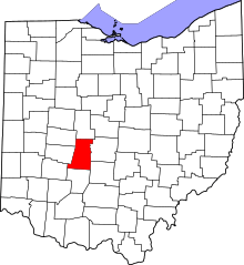 | |
| Villages | ||
| Townships | ||
| CDPs | ||
| Unincorporated communities | ||
| Footnotes | ‡This populated place also has portions in an adjacent county or counties | |