Pleasant Mount, Pennsylvania
| Pleasant Mount, Pennsylvania | |
|---|---|
| Unincorporated community | |
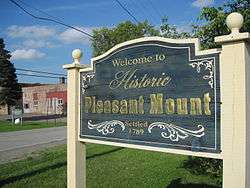 The welcome sign for the Village of Pleasant Mount. | |
| Nickname(s): Mount Pleasant,[1] Mt. Pleasant,[2] Pleasant Mt.[3] | |
 Pleasant Mount, Pennsylvania Pleasant Mount's Location within Pennsylvania. | |
| Coordinates: 41°44′23″N 75°26′4″W / 41.73972°N 75.43444°WCoordinates: 41°44′23″N 75°26′4″W / 41.73972°N 75.43444°W | |
| Country | United States |
| State | Pennsylvania |
| U.S. Congressional District | PA-10 |
| School District | Forest City Regional |
| County | Wayne |
| Magisterial District | 22-3-04[4] |
| Township | Mount Pleasant |
| Settled | June 1789[5] |
| Founded by | Samuel Stanton[5] |
| Named for | Mount Pleasant Township |
| Elevation | 1,982[6] ft (604 m) |
| Time zone | UTC-5 (Eastern (EST)) |
| • Summer (DST) | UTC-4 (Eastern Daylight (EDT)) |
| ZIP codes | 18453[3] |
| Area code(s) | 570 |
| GNIS feature ID | 1184047[6] |
| FIPS code | 42-127-51872[7]-61344[6] |
| Major Roads |
|
| Waterways | Biglow Lake,[8] Lackawaxen River (West Branch) |
Pleasant Mount is an unincorporated community in Mount Pleasant Township, Wayne County, Pennsylvania, in the Lake Region of the Poconos.
References
- ↑ White, Israel Charles; Dolph, John M. (1881). The Geology of Susquehanna County and Wayne County (Report). 23. Board of Commissioners for the Second Geological Survey of Pennsylvania. p. 59. Retrieved 30 January 2016.
- ↑ White & Dolph. p. 170.
- 1 2 "Look up a ZIP CodeTM". USPS.COM. USPS. 2014. Retrieved 30 January 2016.
- ↑ "District Magistrate". Wayne County, PA. Wayne County Courthouse. 2014. Archived from the original on 27 November 2014. Retrieved 30 January 2016.
- 1 2 Whaley, Samuel (1856). History of the Township of Mount Pleasant, Wayne County, Pennsylvania. A Discourse Delivered on Thanksgiving Day, November 22, 1855. New York: M. W. Dodd. p. 9.
- 1 2 3 "Pleasant Mount". Geographic Names Information System. United States Geological Survey. 2 August 1979. Retrieved 30 January 2016.
- ↑ U.S. Census Bureau. Census 2000. "Census Demographic Profiles, Mount Pleasant Township" (PDF). CenStats Databases. Retrieved 30 January 2016.
- ↑ "Biglow Lake". Geographic Names Information System. United States Geological Survey. 2 August 1979. Retrieved 18 February 2016.
Municipalities and communities of Wayne County, Pennsylvania, United States | ||
|---|---|---|
| Boroughs | 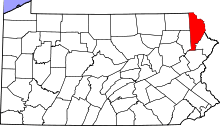 | |
| Townships | ||
| CDPs | ||
| Unincorporated communities | ||
This article is issued from
Wikipedia.
The text is licensed under Creative Commons - Attribution - Sharealike.
Additional terms may apply for the media files.