Pleasant Grove, Maryland
| Pleasant Grove, Maryland | |
|---|---|
| Census-designated place | |
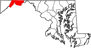
 Location within the State of Maryland  Pleasant Grove, Maryland (the US) | |
| Coordinates: 39°40′42″N 78°41′46″W / 39.67833°N 78.69611°WCoordinates: 39°40′42″N 78°41′46″W / 39.67833°N 78.69611°W | |
| Country |
|
| State |
|
| County |
|
| Area | |
| • Total | 1.6 sq mi (4.1 km2) |
| • Land | 1.6 sq mi (4.1 km2) |
| • Water | 0 sq mi (0 km2) |
| Elevation | 780 ft (240 m) |
| Population (2010) | |
| • Total | 353 |
| • Density | 224/sq mi (86.3/km2) |
| Time zone | UTC−5 (Eastern (EST)) |
| • Summer (DST) | UTC−4 (EDT) |
| FIPS code | 24-62100 |
| GNIS feature ID | 2583672 |
Pleasant Grove is a census-designated place (CDP) in Allegany County, Maryland, United States. As of the 2010 census it had a population of 353.[1]
Pleasant Grove is located east of Cumberland along Maryland Route 144 (Baltimore Pike), the old alignment of U.S. Route 40. Interstate 68, the new highway alignment, also runs through the CDP, with access via Exit 47 at the western end of the community.
References
- ↑ "Geographic Identifiers: 2010 Demographic Profile Data (G001): Pleasant Grove CDP, Maryland". U.S. Census Bureau, American Factfinder. Retrieved May 29, 2013.
- U.S. Geological Survey Geographic Names Information System: Pleasant Grove, Maryland
- U.S. Geological Survey Geographic Names Information System: Pleasant Grove Census Designated Place
This article is issued from
Wikipedia.
The text is licensed under Creative Commons - Attribution - Sharealike.
Additional terms may apply for the media files.