Borden Shaft, Maryland
| Shaft, Maryland | |
|---|---|
| Census-designated place | |
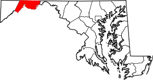
 Location within the State of Maryland  Borden Shaft, Maryland (the US) | |
| Coordinates: 39°37′37″N 78°56′12″W / 39.62694°N 78.93667°WCoordinates: 39°37′37″N 78°56′12″W / 39.62694°N 78.93667°W | |
| Country |
|
| State |
|
| County |
|
| Area | |
| • Total | 0.80 sq mi (2.06 km2) |
| • Land | 0.79 sq mi (2.04 km2) |
| • Water | 0.01 sq mi (0.03 km2) |
| Elevation | 1,795 ft (547 m) |
| Population (2010) | |
| • Total | 235 |
| • Density | 299/sq mi (115.4/km2) |
| Time zone | UTC−5 (Eastern (EST)) |
| • Summer (DST) | UTC−4 (EDT) |
| FIPS code | 24-71460 |
| GNIS feature ID | 2583687 |
Shaft is a census-designated place (CDP) corresponding to the unincorporated community of Borden Shaft[1] in Allegany County, Maryland, United States. As of the 2010 census, the CDP had a population of 235.[2] It is located south of Frostburg, in the Georges Creek Valley. It lies at an elevation of 1,795 feet (547 m).Borden, or Borden Shaft, was the site of a major deep mine in the Valley. The principal owners of the mines were the Borden family of Massachusetts. Deep mines were unusual in the area, as most were drift mines in the Big Vein region. In 1907, the mine operator was H. and W. Hitchens Coal company. The C&P railroad delivered the windlass for the mine, then used its railroad crane to set it in place.[1]
References
- 1 2 U.S. Geological Survey Geographic Names Information System: Borden Shaft
- ↑ "Geographic Identifiers: 2010 Demographic Profile Data (G001): Shaft CDP, Maryland". U.S. Census Bureau, American Factfinder. Retrieved May 29, 2013.
This article is issued from
Wikipedia.
The text is licensed under Creative Commons - Attribution - Sharealike.
Additional terms may apply for the media files.