Plague of Mohill
In 6th century Ireland, the population of Mohill barony was devastated by the Justinian plague, an early phenomenon of the Late Antique Little Ice Age c. 536-660 AD. The Mohill plague occurred following the Extreme weather events of 535–536 and death of Manchán of Mohill.
Causes
A sudden climate change in the decade after 538 can be observed from dendrochonology studies of Irish trees, and the arrival of the Bubonic plague in Ireland c. A.D. 544, seems to correlate with the westward trajectory of the Justinianic plague, which had reached Gaul by A.D. 543.[1]
The Four Masters states: "543AD, an extraordinary universal plague through the world, which swept away the noblest third part of the human race",[2] and the Annals of Ulster christened the pandemic "bléfed".[3] It is estimated 25–50 million, or 40% of European population, died over two centuries as the plague returned periodically until the 8th century.
Mohill plague
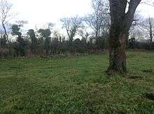
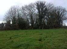
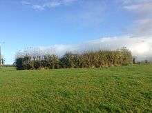
Evidence for the Justinian plague is provided by three contiguous townlands to the south-west of Mohill town, named Tamlaght More, Tamlaght Beg, and Tamlaghtavally. These mass burial sites formed a quadrant shape around the former monastery of Mohill.[4][5] Tamlaght (Irish: Taimhleacht) is a pagan name.[6] Recognition the word tamlacht signifies a mass plague burial place is widespread, but most communities retain little knowledge of their own localities experience.[7][8]
Gaffney (1975), a local scholar from Mohill described the local plague as follows - "Tamlaghavally townland: Taibhleacht a' Bhaile or Taibhleacht an Bhealaigh, the plague burial ground of the town or roadway. Taibhleacht is derived from tamh or taimh, an unnatural death as from plague, and leacht signifies a bed or grave, a place where people who died from a plague were buried, generally in a common grave. People who passed the way were accustomed to raise a 'cairn' of stones over the spot by placing single stones over the grave. TamlaghtBeg and TamlaghMore are of the same origin. Some great plague or pestilence left its name on those three townlands."[9]
Dooley states that another epidemic in A.D. 550, christened the croin Chonaill (redness of C.), or the buidhe Chonaill (yellowness of C.), suggests a fairly widespread outbreak focused on the Shannon area.[10] Hanley recorded that nearly all 41 Tamlachta sites northern half of Ireland are associated with water, though Mohill seemed to be the exception.[11][5][n 1] The bordering Airgíalla kingdom was uniquely hard hit by pandemic.[5][12]
Heritage
Haley observed how "the huge dying off in the 6th century, which is suggested by the number of tamlachta sites, would certainly have created fear if not widespread panic. This was a pandemic in which some people dropped dead in less than one day, some fell ill but recovered, and some remained unaffected. Such seemingly random results might have been interpreted by the populace, even preached by the clerics, as evidence of divine selection."[13] There was a great surge in ringfort-building after the plague of 545 AD, as the populace on the boundary of devastated regions, Airgíalla and Mohill (barony), sought security from mysterious and widespread death, riving, cattle-raids, enslavement, and worse.[14] These forts (called Raths) were entrenchments the Irish built about their houses.[15] Numerous remains of these forts are visible around ancient barony of Mohill.
Notes and references
Notes
- ↑ But Mohill (Irish: Maothail "soft or spongy place") is associated with water, the nearby Lough Rinn feeding the Rinn river, a tributary of the Shannon river.
Citations
- ↑ Dooley 2007, pp. 216.
- ↑ AFM.
- ↑ Bambury, Beechinor 2000, pp. U545.1.
- ↑ Haley 2002, pp. 117.
- 1 2 3 Murray 2005, pp. 105-106.
- ↑ Joyce 1913, pp. 567.
- ↑ Murray 2005, pp. 105-106,n25.
- ↑ Haley 2002, pp. 108.
- ↑ Gaffey 1975, pp. Tamlaghavally.
- ↑ Dooley 2007, pp. 217.
- ↑ Haley 2002, pp. 105.
- ↑ Haley 2002, pp. 107.
- ↑ Haley 2002, pp. 111.
- ↑ Haley 2002, pp. 114.
- ↑ O Rodaighe 1700, pp. 5.
Primary sources
- Haley, Gene C. (2002). "Tamlachta: The Map of Plague Burials and Some Implications for Early Irish History". 22, Proceedings of the Harvard Celtic Colloquium. Department of Celtic Languages & Literatures, Harvard University: 96–140. JSTOR 40285165.
- Dooley, Ann (2007). Lester K. Little, ed. The Plague and Its Consequences in Ireland. Plague and the End of Antiquity, The PAndemic of 541-750. Cambridge University Press. pp. 215–230. ISBN 0511335261.
- Gaffey, Matt (1975). "Place names of Mohill". Michael Whelan, mohillparish.ie.
Secondary sources
- Murray, Kevin (2005). Riitta Latvio, ed. Dialect in medieval Irish? Evidence from placenames (PDF). Studia Celtica Fennica II, Essays in Honour of Anders Ahlqvist (Yearbook ed.). Finnish Society for Celtic Studies SFKS. pp. 97–109.
- Joyce, P. W. (Patrick Weston) (1913). Irish names of places (PDF). v.3. Dublin : Phoenix.
- Bambury, Pádraig; Beechinor, Stephen (2000). "The Annals of Ulster" (Electronic edition compiled by the CELT Team (2000) ed.). CELT: Corpus of Electronic Texts: a project of University College Cork College Road, Cork, Ireland—http://www.ucc.ie/celt. pp. U536.3, U539.1, U545.1.
- Annals of the Four Masters, ed. & tr. John O'Donovan (1856). Annála Rioghachta Éireann. Annals of the Kingdom of Ireland by the Four Masters... with a Translation and Copious Notes. 7 vols (2nd ed.). Dublin: Royal Irish Academy. CELT editions. Full scans at Internet Archive: Vol. 1; Vol. 2; Vol. 3; Vol. 4; Vol. 5; Vol. 6; Indices.
- O Rodaighe, Tadhg (1700). "Tadhg O Rodaighe to [Edward Lhwyd]" (PDF). Dublin, Trinity College Dublin, a document bound into MS 1318 (donated from Edward Lhuyd collection): Rev. J. H. Todd, D. D., ‘Autograph Letter of Thady O’Roddy’, The Miscellany of the Irish Archaeological Society 1 (1846), 112–125. Archived from the original (PDF) on 6 October 2016. Retrieved 31 August 2016.