Piz Platta
| Piz Platta | |
|---|---|
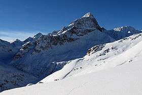 View from the east side | |
| Highest point | |
| Elevation | 3,392 m (11,129 ft) |
| Prominence | 1,108 m (3,635 ft) [1] |
| Isolation | 11.7 km (7.3 mi) [2] |
| Parent peak | Piz Kesch |
| Coordinates | 46°29′13.1″N 9°33′42.2″E / 46.486972°N 9.561722°ECoordinates: 46°29′13.1″N 9°33′42.2″E / 46.486972°N 9.561722°E |
| Geography | |
 Piz Platta Location in Switzerland | |
| Location | Graubünden, Switzerland |
| Parent range | Oberhalbstein Alps |
Piz Platta is the highest peak in the Oberhalbstein Alps. It is 3392 metres high (Source: Landeskarte der Schweiz no.1256 - 1991), and is notable for its similarity in shape to the Matterhorn. Piz Platta is located between the localities of Avers and Mulegns, both in the Swiss canton of Graubünden.
See also
References
- ↑ Retrieved from the Swisstopo topographic maps. The key col is the Julier Pass (2,284 m).
- ↑ Retrieved from Google Earth. The nearest point of higher elevation is west of Piz Calderas.
External links
| Wikimedia Commons has media related to Piz Platta. |
This article is issued from
Wikipedia.
The text is licensed under Creative Commons - Attribution - Sharealike.
Additional terms may apply for the media files.