Piz Calderas
| Piz Calderas | |
|---|---|
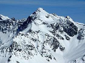 View from the south-west | |
| Highest point | |
| Elevation | 3,397 m (11,145 ft) |
| Prominence | 1,085 m (3,560 ft) [1] |
| Isolation | 16.5 km (10.3 mi) [2] |
| Parent peak | Piz Kesch |
| Coordinates | 46°32′11.1″N 09°41′45.6″E / 46.536417°N 9.696000°ECoordinates: 46°32′11.1″N 09°41′45.6″E / 46.536417°N 9.696000°E |
| Geography | |
 Piz Calderas Location in Switzerland | |
| Location | Graubünden, Switzerland |
| Parent range | Albula Alps |
Piz Calderas is a mountain of the Albula Alps, overlooking Mulegns in the canton of Graubünden. It is the highest summit of the group located between the Julier and Albula Pass. On its east side lies the Val Bever.
See also
References
- ↑ Retrieved from the Swisstopo topographic maps. The key col is the Albula Pass (2,312 m).
- ↑ Retrieved from Google Earth. The nearest point of higher elevation is west of Piz Kesch.
External links
| Wikimedia Commons has media related to Piz Calderas. |
This article is issued from
Wikipedia.
The text is licensed under Creative Commons - Attribution - Sharealike.
Additional terms may apply for the media files.