Pinchbeck, Lincolnshire
| Pinchbeck | |
|---|---|
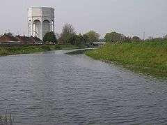 Water tower and bridge | |
 Pinchbeck Pinchbeck shown within Lincolnshire | |
| Population | 5,153 [1] |
| OS grid reference | TF240255 |
| • London | 90 mi (140 km) S |
| Civil parish |
|
| District | |
| Shire county | |
| Region | |
| Country | England |
| Sovereign state | United Kingdom |
| Post town | SPALDING |
| Postcode district | PE11 |
| Dialling code | 01775 |
| Police | Lincolnshire |
| Fire | Lincolnshire |
| Ambulance | East Midlands |
| EU Parliament | East Midlands |
| UK Parliament | |
Pinchbeck is a village and civil parish in the South Holland district of Lincolnshire, England. The civil parish population was 5,153 at the 2001 census, increasing to 5,455 at the 2011 census.[2] It is situated 2 miles (3.2 km) north from the centre of Spalding.
The name Pinchbeck is derived from either the Old English pinc+bece (Minnow Stream) or pinca+bece (Finch Ridge). A family long associated with the area took its name from the village, one member of which was Christopher Pinchbeck, a watchmaker responsible for the invention of the Pinchbeck alloy, which was once used for imitating gold in cheap jewellery.[3]
The Anglican village church is dedicated to Saint Mary, and is over 1,000 years old. It has a wide nave with mid-12th-century arches, and a 15th-century single hammer-beam roof supported by large gilded angels carrying the heraldic escutcheons of the Pinchbeck family. The chancel is by restorer Herbert Butterfield.[4]
Village schools are Pinchbeck East C of E School Primary School and Pinchbeck West St Bartholomew's C of E Primary School.
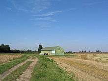
Pinchbeck Marsh
Pinchbeck falls within the drainage area of the Welland and Deepings Internal Drainage Board.[5] The board maintains Pinchbeck Engine House, a museum which houses a drain engine, built to drain Pinchbeck Marsh in the early 19th century.
The marsh is also the location of the highest point in what was Parts of Holland an historic division of Lincolnshire. At only 8 metres above sea level, the high point at TF27872860 is the lowest of those listed for the historic counties and subdivisions in 1964. Visiting this lowest peak near Vernatt's Drain is of interest to participants in the sport of Hill bagging and Highpointing.[6]
References
- ↑ "Pinchbeck and Surfleet Ward Profile" (PDF). Retrieved 16 April 2014.
- ↑ "Civil Parish population 2011". Neighbourhood Statistics. Office for National Statistics. Retrieved 26 May 2016.
- ↑ Stokes, H.G. (1948). "Legends and Words". English Place-Names. Edinburgh: B. T. Batsford Ltd. p. 63.
- ↑ Thorold, Henry (1989). Lincolnshire Churches Revisited. p. 148.
- ↑ "Welland and Deepings IDB". Retrieved 16 April 2014.
- ↑ Pinchbeck Marsh
External links

- Pinchbeck East C of E Primary School
- Burtey Fen Collection
England Portal | |
| Unitary authorities | |
| Boroughs or districts | |
| Major settlements |
|
| Topics | |