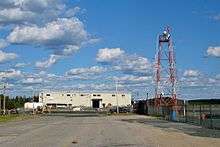
Pickle Lake Airport
| Pickle Lake Airport | |||||||||||
|---|---|---|---|---|---|---|---|---|---|---|---|
 | |||||||||||
| Summary | |||||||||||
| Airport type | Public | ||||||||||
| Operator | Government of Ontario | ||||||||||
| Location | Pickle Lake, Ontario | ||||||||||
| Time zone | EST (UTC−05:00) | ||||||||||
| Elevation AMSL | 1,268 ft / 386 m | ||||||||||
| Coordinates | 51°26′47″N 090°12′48″W / 51.44639°N 90.21333°WCoordinates: 51°26′47″N 090°12′48″W / 51.44639°N 90.21333°W | ||||||||||
| Map | |||||||||||
 CYPL Location in Ontario  CYPL CYPL (Canada) | |||||||||||
| Runways | |||||||||||
| |||||||||||
| Statistics (2010) | |||||||||||
| |||||||||||
Pickle Lake Airport, (IATA: YPL, ICAO: CYPL), is located 0.7 nautical miles (1.3 km; 0.81 mi) southwest of Pickle Lake, Ontario, Canada. It is serviced by North Star Air and Wasaya Airways with regular scheduled flights from Thunder Bay and Sioux Lookout.
Accidents and incidents
- On 12 May 1977, Douglas R4D-1 C-FBKV of Patricia Air Services was written off in an accident. One person was killed.[4]
- On 11 May 1987, Douglas C-47B C-FADD of Air Manitoba crashed near Pickle Lake after a structural failure of the port wing. The aircraft was on a domestic cargo flight from Big Trout Lake Airport to Pickle Lake Airport. Both crew were killed.[5]
- On 17 March 2017, Basler BT-67 C-FKGL of Private Air crashed on take-off for Big Trout Airport, Ontario. All three crew survived.[6]
See also
References
- ↑ Canada Flight Supplement. Effective 0901Z 19 July 2018 to 0901Z 13 September 2018.
- ↑ Synoptic/Metstat Station Information
- ↑ Total aircraft movements by class of operation
- ↑ "C-FBKV Accident description". Aviation Safety Network. Retrieved 4 August 2010.
- ↑ "C-FADD Accident description". Aviation Safety Network. Retrieved 27 July 2010.
- ↑ "C-FKGL accident description". Aviation Safety Network. Retrieved 29 March 2017.
External links
- Past three hours METARs, SPECI and current TAFs for Pickle Lake Airport from Nav Canada as available.
| By name | |
|---|---|
| By location indicator | |
| By province/territory | |
| By area | |
| National Airports System | |
| Related | |
| |
This article is issued from
Wikipedia.
The text is licensed under Creative Commons - Attribution - Sharealike.
Additional terms may apply for the media files.