Phu Kradueng District
| Phu Kradueng ภูกระดึง | |
|---|---|
| Amphoe | |
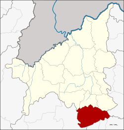 Amphoe location in Loei Province | |
| Coordinates: 16°53′3″N 101°53′4″E / 16.88417°N 101.88444°ECoordinates: 16°53′3″N 101°53′4″E / 16.88417°N 101.88444°E | |
| Country | Thailand |
| Province | Loei |
| Seat | Phu Kradueng |
| Area | |
| • Total | 709.0 km2 (273.7 sq mi) |
| Population (2005) | |
| • Total | 33,438 |
| • Density | 47.2/km2 (122/sq mi) |
| Time zone | UTC+7 (ICT) |
| Postal code | 42180 |
| Geocode | 4210 |
Phu Kradueng (Thai: ภูกระดึง; IPA: [pʰūː krādɯ̄ŋ]) is a district (amphoe) of Loei Province, northeastern Thailand.
Geography
Neighboring districts are (from the north clockwise) Phu Luang, Nong Hin, and Pha Kao of Loei Province, Si Bun Rueang of Nong Bua Lamphu Province, Si Chomphu, Chum Phae, and Phu Pha Man of Khon Kaen Province, and Nam Nao of Phetchabun Province.
Phu Kradueng mountain is in the district.
History
The minor district (king amphoe) was created on 1 January 1962, when the three tambon Si Than, Puan Phu, and Pha Khao were split off from Wang Saphung district.[1] It was upgraded to a full district on 16 July 1963.[2]
Administration
The district is divided into four sub-districts (tambon), which are further subdivided into 54 villages (muban). Phu Kradueng is a township (thesaban tambon) which covers parts of tambon Si Than, Pha Nok Khao, and Phu Kradueng. There are a further four tambon administrative organizations (TAO).
| No. | Name | Thai name | Villages | Pop. | |
|---|---|---|---|---|---|
| 1. | Si Than | ศรีฐาน | 16 | 10,963 | |
| 5. | Pha Nok Khao | ผานกเค้า | 14 | 8,140 | |
| 7. | Phu Kradueng | ภูกระดึง | 13 | 7,698 | |
| 10. | Huai Som | ห้วยส้ม | 11 | 6,637 |
Missing numbers are tambons which now form the Districts Pha Khao and Nong Hin.
References
- ↑ ประกาศกระทรวงมหาดไทย เรื่อง การแบ่งท้องที่ตั้งเป็นกิ่งอำเภอ (PDF). Royal Gazette (in Thai). 79 (4 ง): 32–33. 9 January 1962.
- ↑ พระราชกฤษฎีกาตั้งอำเภอบ่อพลอย อำเภอไทรโยค อำเภอหนองปรือ อำเภอหนองสองห้อง อำเภอประทาย อำเภอห้วยแถลง อำเภอละหานทราย อำเภอกุยบุรี อำเภอตาพระยา อำเภอหนองไผ่ อำเภอนาเชือก อำเภอวัดเพลง อำเภอพนัสนิคม อำเภอภูกระดึง อำเภอปรางค์กู่ อำเภอท่าช้าง อำเภอบ้านด่านลานหอย อำเภอบ้านดุง อำเภอสว่างอารมณ์ และอำเภอกุดชุม พ.ศ. ๒๕๐๖ (PDF). Royal Gazette (in Thai). 80 (72 ก): 362–366. 16 July 1963.
| Wikimedia Commons has media related to Phu Kradueng District. |
External links