Nong Hin District
| Nong Hin หนองหิน | |
|---|---|
| Amphoe | |
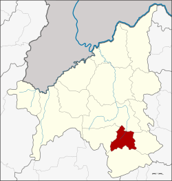 Amphoe location in Loei Province | |
| Coordinates: 17°7′24″N 101°51′30″E / 17.12333°N 101.85833°ECoordinates: 17°7′24″N 101°51′30″E / 17.12333°N 101.85833°E | |
| Country | Thailand |
| Province | Loei |
| Seat | Nong Hin |
| Area | |
| • Total | 435.0 km2 (168.0 sq mi) |
| Population (2005) | |
| • Total | 23,255 |
| • Density | 53.5/km2 (139/sq mi) |
| Time zone | UTC+7 (ICT) |
| Postal code | 42190 |
| Geocode | 4214 |
Nong Hin (Thai: หนองหิน; IPA: [nɔ̌ːŋ hǐn]) is a district (amphoe) of Loei Province, northeastern Thailand.
Geography
Neighboring districts are (from the north clockwise) Wang Saphung, Pha Khao, Phu Kradueng, and Phu Luang.
History
The minor district (king amphoe) was established on 1 July 1997 with territory split off from Phu Kradueng.[1]
Following a decision of the Thai government on 15 May 2007, all of the 81 minor districts were upgraded to full districts.[2] With publication in the Royal Gazette on 24 August, the upgrade became official .[3]
Administration
The district is divided into three sub-districts (tambon), which are further subdivided into 34 villages (muban). Nong Hin is a township (thesaban tambon) which covers parts of tambon Nong Hin. There are a further three tambon administrative organizations (TAO).
| No. | Name | Thai name | Villages | Pop. | |
|---|---|---|---|---|---|
| 1. | Nong Hin | หนองหิน | 14 | 9,711 | |
| 2. | Tat Kha | ตาดข่า | 5 | 4,060 | |
| 3. | Puan Phu | ปวนพุ | 15 | 9,484 |
References
- ↑ ประกาศกระทรวงมหาดไทย เรื่อง แบ่งเขตท้องที่อำเภอภูกระดึง จังหวัดเลย ตั้งเป็นกิ่งอำเภอหนองหิน (PDF). Royal Gazette (in Thai). 118 (Special 51 ง): 19. 25 June 1997.
- ↑ แถลงผลการประชุม ครม. ประจำวันที่ 15 พ.ค. 2550 (in Thai). Manager Online.
- ↑ พระราชกฤษฎีกาตั้งอำเภอฆ้องชัย...และอำเภอเหล่าเสือโก้ก พ.ศ. ๒๕๕๐ (PDF). Royal Gazette (in Thai). 124 (46 ก): 14–21. 24 August 2007.