Phon Sai District
| Phon Sai โพนทราย | |
|---|---|
| Amphoe | |
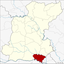 Amphoe location in Roi Et Province | |
| Coordinates: 15°29′16″N 103°59′47″E / 15.48778°N 103.99639°ECoordinates: 15°29′16″N 103°59′47″E / 15.48778°N 103.99639°E | |
| Country | Thailand |
| Province | Roi Et |
| Seat | Phon Sai |
| Area | |
| • Total | 215.852 km2 (83.341 sq mi) |
| Population (2005) | |
| • Total | 27,420 |
| • Density | 127.0/km2 (329/sq mi) |
| Time zone | UTC+7 (ICT) |
| Postal code | 45240 |
| Geocode | 4513 |
Phon Sai (Thai: โพนทราย, pronounced [pʰōːn sāːj]) is a district (amphoe) in the southeastern part of Roi Et Province, northeastern Thailand.
Geography
Neighboring districts are (from the west clockwise) Suwannaphum and Nong Hi of Roi Et Province, Sila Lat and Rasi Salai of Sisaket Province and Rattanaburi of Surin Province.
History
The minor district (king amphoe) Phon Sai was established on 16 November 1976, when the two tambon Phon Sai and Samkha were split off from Suwannaphum District.[1] It was upgraded to a full district on 25 May 1989.[2]
Administration
The district is divided into five sub-districts (tambon), which are further subdivided into 58 villages (muban). Phon Sai is a township (thesaban tambon) which covers parts of tambon Phon Sai. There are a further four tambon administrative organizations (TAO).
| No. | Name | Thai name | Villages | Pop. | |
|---|---|---|---|---|---|
| 1. | Phon Sai | โพนทราย | 14 | 6,385 | |
| 2. | Samkha | สามขา | 9 | 4,477 | |
| 3. | Si Sawang | ศรีสว่าง | 15 | 7,448 | |
| 4. | Yang Kham | ยางคำ | 10 | 4,403 | |
| 5. | Tha Hat Yao | ท่าหาดยาว | 10 | 4,707 |
References
- ↑ ประกาศกระทรวงมหาดไทย เรื่อง แบ่งท้องที่อำเภอสุวรรณภูมิ จังหวัดร้อยเอ็ด ตั้งเป็นกิ่งอำเภอโพนทราย (PDF). Royal Gazette (in Thai). 93 (146 ง): 3465. November 23, 1976.
- ↑ พระราชกฤษฎีกาตั้งอำเภอแวงใหญ่ อำเภอหนองบุนนาก อำเภอโพนทราย อำเภอท่าหลวง และอำเภอศรีรัตนะ พ.ศ. ๒๕๓๒ (PDF). Royal Gazette (in Thai). 106 (83 ก special): 249–251. May 25, 1989.
External links