Chaturaphak Phiman District
| Chaturaphak Phiman จตุรพักตรพิมาน | |
|---|---|
| Amphoe | |
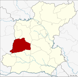 Amphoe location in Roi Et Province | |
| Coordinates: 15°50′46″N 103°33′25″E / 15.84611°N 103.55694°ECoordinates: 15°50′46″N 103°33′25″E / 15.84611°N 103.55694°E | |
| Country | Thailand |
| Province | Roi Et |
| Seat | Hua Chang |
| Area | |
| • Total | 522.0 km2 (201.5 sq mi) |
| Population (2005) | |
| • Total | 81,749 |
| • Density | 148.9/km2 (386/sq mi) |
| Time zone | UTC+7 (ICT) |
| Postal code | 45180 |
| Geocode | 4504 |
Chaturaphak Phiman (Thai: จตุรพักตรพิมาน) is a district (amphoe) in the western part of Roi Et Province, Thailand.
Geography
Neighboring districts are (from the north clockwise) Si Somdet, Mueang Roi Et, At Samat (at a single point), Mueang Suang, Kaset Wisai of Roi Et Province and Wapi Pathum of Maha Sarakham Province.
History
The district was renamed from Hua Chang to Chaturaphak Phiman in 1939.[1]
Administration
The district is divided into 12 sub-districts (tambon), which are further subdivided into 146 villages (muban). Chaturaphak Phiman is a township (thesaban tambon) which covers parts of tambon Hua Chang. There are a further 12 tambon administrative organizations (TAO).
| No. | Name | Thai name | Villages | Pop. | |
|---|---|---|---|---|---|
| 1. | Hua Chang | หัวช้าง | 13 | 12,642 | |
| 2. | Nong Phue | หนองผือ | 11 | 7,687 | |
| 3. | Mueang Hong | เมืองหงส์ | 17 | 7,601 | |
| 4. | Khok Lam | โคกล่าม | 16 | 7,493 | |
| 5. | Nam Sai | น้ำใส | 9 | 5,140 | |
| 6. | Dong Daeng | ดงแดง | 15 | 9,029 | |
| 7. | Dong Klang | ดงกลาง | 9 | 5,982 | |
| 8. | Pa Sang | ป่าสังข์ | 14 | 6,123 | |
| 9. | I Ngong | อีง่อง | 9 | 4,354 | |
| 10. | Lin Fa | ลิ้นฟ้า | 10 | 4,581 | |
| 11. | Du Noi | ดู่น้อย | 14 | 6,712 | |
| 12. | Si Khot | ศรีโคตร | 9 | 4,405 |
References
- ↑ พระราชกฤษฎีกาเปลี่ยนนามอำเภอ กิ่งอำเภอ และตำบลบางแห่ง พุทธศักราช ๒๔๘๒ (PDF). Royal Gazette (in Thai). 56 (0 ก): 354–364. April 17, 1939.
External links
This article is issued from
Wikipedia.
The text is licensed under Creative Commons - Attribution - Sharealike.
Additional terms may apply for the media files.