At Samat District
| At Samat อาจสามารถ | |
|---|---|
| Amphoe | |
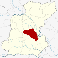 Amphoe location in Roi Et Province | |
| Coordinates: 15°50′37″N 103°52′44″E / 15.84361°N 103.87889°ECoordinates: 15°50′37″N 103°52′44″E / 15.84361°N 103.87889°E | |
| Country | Thailand |
| Province | Roi Et |
| Seat | At Samat |
| Area | |
| • Total | 454.4 km2 (175.4 sq mi) |
| Population (2015) | |
| • Total | 74,333 |
| • Density | 164.4/km2 (426/sq mi) |
| Time zone | UTC+7 (ICT) |
| Postal code | 45160 |
| Geocode | 4514 |
At Samat (Thai: อาจสามารถ, pronounced [ʔàːt sǎː.mâːt]) is a district (amphoe) of Roi Et Province, Thailand.
Geography
The district is in central Roi Et Province. Neighboring districts are (from the north clockwise) Thawat Buri, Thung Khao Luang, Selaphum, Phanom Phrai, Suwannaphum, Mueang Suang, Chaturaphak Phiman (at a single point) and Mueang Roi Et.
History
The district was created in 1897, at first named Sabut (สระบุศย์). In 1913 it was renamed At Samat.[1]
In January 2006 Prime Minister Thaksin Shinawatra chose At Samat as the model district for his poverty eradication program. He visited the district and led a five-day workshop. The event was shown as a reality TV show named Backstage: The Prime Minister.
Administration
Central administration
The At Samat District is divided into 10 sub-districts (Tambon), which are further subdivided into 139 administrative villages (muban).
| No. | Name | Thai | Villages | Pop.[2] |
|---|---|---|---|---|
| 1. | At Samat | อาจสามารถ | 17 | 10,963 |
| 2. | Phon Mueang | โพนเมือง | 17 | 9,191 |
| 3. | Ban Chaeng | บ้านแจ้ง | 9 | 5,540 |
| 4. | Nom | หน่อม | 13 | 6,904 |
| 5. | Nong Muen Than | หนองหมื่นถ่าน | 17 | 9,192 |
| 6. | Nong Kham | หนองขาม | 19 | 10,318 |
| 7. | Hora | โหรา | 14 | 7,682 |
| 8. | Nong Bua | หนองบัว | 10 | 4,232 |
| 9. | Khilek | ขี้เหล็ก | 12 | 4,717 |
| 10. | Ban Du | บ้านดู่ | 11 | 5,594 |
Local administration
There are two sub-district municipalities (Thesaban Tambon) in the district:
- At Samat (Thai: เทศบาลตำบลอาจสามารถ) consisting of parts of sub-district At Samat.
- Phon Mueang (Thai: เทศบาลตำบลโพนเมือง) consisting of the entire sub-district Phon Mueang.
There are nine sub-district administrative organizations (SAO) in the district:
- At Samat (Thai: องค์การบริหารส่วนตำบลอาจสามารถ) consisting of parts of sub-district At Samat.
- Ban Chaeng (Thai: องค์การบริหารส่วนตำบลบ้านแจ้ง) consisting of the entire sub-district Ban Chaeng.
- Nom (Thai: องค์การบริหารส่วนตำบลหน่อม) consisting of the entire sub-district Nom.
- Nong Muen Than (Thai: องค์การบริหารส่วนตำบลหนองหมื่นถ่าน) consisting of the entire sub-district Nong Muen Than.
- Nong Kham (Thai: องค์การบริหารส่วนตำบลหนองขาม) consisting of the entire sub-district Nong Kham.
- Hora (Thai: องค์การบริหารส่วนตำบลโหรา) consisting of the entire sub-district Hora.
- Nong Bua (Thai: องค์การบริหารส่วนตำบลหนองบัว) consisting of the entire sub-district Nong Bua.
- Khilek (Thai: องค์การบริหารส่วนตำบลขี้เหล็ก) consisting of the entire sub-district Khilek.
- Ban Du (Thai: องค์การบริหารส่วนตำบลบ้านดู่) consisting of the entire sub-district Ban Du.
References
- ↑ แจ้งความกระทรวงมหาดไทย เรื่อง เปลี่ยนนามอำเภอ (PDF). Royal Gazette (in Thai). 30 (0 ง): 1619–1620. October 19, 1913.
- ↑ "Population statistics 2015" (in Thai). Department of Provincial Administration. Retrieved 2016-03-24.
External links
- Amphoe (Thai)