Wilmot, Ontario
| Wilmot | |
|---|---|
| Township (lower-tier) | |
| Township of Wilmot | |
 Peel Street in New Hamburg | |
| Motto(s): Building a Sure Foundation | |
 Wilmot | |
| Coordinates: 43°24′N 80°39′W / 43.400°N 80.650°WCoordinates: 43°24′N 80°39′W / 43.400°N 80.650°W | |
| Country |
|
| Province |
|
| Region | Waterloo |
| Settled | 1822 |
| Incorporated | 1850 |
| Government | |
| • Mayor | Les Armstrong |
| • Councillors | Al Junker, Peter Roe, Barry Fisher, Jeff Gerber, Mark Murray |
| • Federal riding | Kitchener—Conestoga |
| • Prov. riding | Kitchener—Conestoga |
| Area[1] | |
| • Land | 263.72 km2 (101.82 sq mi) |
| Elevation | 370 m (1,210 ft) |
| Population (2011)[1] | |
| • Total | 19,223 |
| • Density | 72.9/km2 (189/sq mi) |
| Time zone | UTC-5 (EST) |
| • Summer (DST) | UTC-4 (EDT) |
| Postal Code | N3A |
| Area code(s) | 519 and 226 |
| Website | www.wilmot.ca |
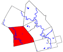
The Township of Wilmot is a rural township in the Regional Municipality of Waterloo in southwestern Ontario, Canada.
History
Wilmot Township was a Crown Reserve by 1791. After a survey in 1824, Mennonites from Waterloo Township and Amish from Europe began to settle here. After 1828, Roman Catholics and Lutherans from Alsace and Germany, Anglicans from Britain and others arrived and began to develop the area and construct buildings and roads.[2]
Officially, the first settlers, in 1838, were John Meyer, Peter Wilker, Jacob Stoebler, Deobold Segler, and John Marteyne. In 1840, the township became part of the District of Wellington and received the right to elect officials and to tax land owners. The first Township council was elected in January 1850.[2]
At the 1841 population count there were 2,200 people, most of whom were "Germans". The post office opened in 1844.
Records from 1846 indicate that the township consisted of 51,463 acres of which 15,310 were being cultivated. Existing villages included Hamburg and Haysville, and there were two grist mills and nine sawmills on the Nith River, or Smith's Creek.[3]
By 1864, the township included a Lutheran church, a tannery, one store, two hotels, two wagon makers, shoe and boot makers, as well as carpenters and mechanics. The school had about 60 students. The settlement was receiving mail daily.[4] There were also two Roman Catholic Separate Schools in the township of Wilmot in 1864.[5][3]
Some of the original settlements have Heritage signs indicating their location in the 1800s: Holland Mills, Josephsburg, New Prussia, Pinehill, Punkeydoodle's Corner, Rosebank, Victoriaburg, and Waldau.[2]
Communities
The township comprises the communities of Baden, Berlett's Corners, Haysville, Josephburg, Luxemburg, Mannheim, New Dundee, New Hamburg, New Prussia, Petersburg, Phillipsburg, St. Agatha, Schindelsteddle and Wilmot Centre, as well as most of Punkeydoodles Corners, a crossroads which straddles the municipal boundaries of Wilmot, East Zorra – Tavistock and Perth East.
St. Agatha was initially called Wilmot and then it was renamed probably after the local Catholic church that had been built in the 1830s.[2] Most early settlers to this area were German: Amish Mennonites, Lutherans, and Roman Catholics. The latter were the majority, making St. Agatha the centre of Catholic community in the Township. By 1834, there were two public log schools and a Catholic log school. More modern school buildings were erected about 20 years later. The Amish Mennonites built their meeting house in 1885.[6]
Some of the settlers moved on to other areas so the community remained small. In 1869, the population was only and by 1890 it had dropped to 200. By 1906, there was a hotel, a blacksmith shop, some stores and various tradesmen.[6]
Demographics
Population trend:[7]
- Population in 2011: 19,223 (2006–2011 population change: 12.4%)
- Population in 2006: 17,097
- Population in 2001: 14,866
- Population in 1996: 13,831
- Population in 1991: 13,107
Private dwellings occupied by usual residents: 6963 (total dwellings: 7158)
Athletic Programs
- Wilmot Aquatic Aces Swim Club
- New Hamburg Firebirds (Hockey)[8]
- New Hamburg Huskies (Hockey)
See also
References
- 1 2 "Wilmot, Ontario (Code 3530020) census profile". 2011 Census of Population. Statistics Canada. Retrieved 2012-08-17.
- 1 2 3 4 http://www.wilmot.ca/en/living-here/History-of-Wilmot-Township.aspx
- 1 2 Smith, Wm. H. (1846). SMITH'S CANADIAN GAZETTEER - STATISTICAL AND GENERAL INFORMATION RESPECTING ALL PARTS OF THE UPPER PROVINCE, OR CANADA WEST:. Toronto: H. & W. ROWSELL. p. 220.
- ↑ County of Waterloo Gazetteer and General Business Directory, For 1864 (PDF). Mitchell & Co. 1864. p. 170.
- ↑ County of Waterloo Gazetteer and General Business Directory, For 1864 (PDF). Mitchell & Co. 1864.
- 1 2 http://www.waterlooregionmuseum.com/collections-and-research/place-names-in-waterloo-region/wilmot-township/st-agatha/
- ↑ Statistics Canada: 1996, 2001, 2006 census
- ↑ Firebirds, New Hamburg. "New Hamburg Firebirds".
- "Wilmot". Geographical Names Data Base. Natural Resources Canada. Retrieved 2010-10-25.
- "Topographic Map sheet 40P7". Atlas of Canada. Natural Resources Canada. 2010-02-04. Retrieved 2010-10-25.
External links
| Wikimedia Commons has media related to Wilmot, Ontario. |
- Township of Wilmot website
- Ontario Plaques - The First Amish Settlement
- The Region of Waterloo Library has 3 branches in Wilmot Township: Baden, New Dundee, and New Hamburg
Places adjacent to Wilmot, Ontario | |
|---|---|