Petroleum, West Virginia
| Petroleum | |
|---|---|
| Unincorporated community | |
 Petroleum Location within the state of West Virginia  Petroleum Petroleum (the US) | |
| Coordinates: 39°11′27″N 81°16′6″W / 39.19083°N 81.26833°WCoordinates: 39°11′27″N 81°16′6″W / 39.19083°N 81.26833°W | |
| Country | United States |
| State | West Virginia |
| County | Ritchie |
| Time zone | UTC-5 (Eastern (EST)) |
| • Summer (DST) | UTC-4 (EDT) |
| ZIP codes | 26161 |
Petroleum (also Rogers) is an unincorporated community in Ritchie County, West Virginia, United States. Its elevation is 699 feet (213 m).[1] Its post office closed on November 9, 2002, but the community still has a ZIP code of 26161.[2][3] The North Bend Rail Trail passes through the community.[4]
Petroleum was platted in 1854 when the railroad was extended to that point.[5] The community was named after a nearby creek where oil naturally occurs.[5]
References
- ↑ U.S. Geological Survey Geographic Names Information System: Petroleum, West Virginia, Geographic Names Information System, 1980-06-27. Accessed 2008-04-22.
- ↑ "Postmaster Finder - Post Offices by ZIP Code". United States Postal Service. Retrieved December 26, 2011.
- ↑ Zip Code Lookup
- ↑ DeLorme (1997). West Virginia Atlas & Gazetteer. Yarmouth, Maine: DeLorme. ISBN 0-89933-246-3.
- 1 2 Kenny, Hamill (1945). West Virginia Place Names: Their Origin and Meaning, Including the Nomenclature of the Streams and Mountains. Piedmont, WV: The Place Name Press. p. 482.
Municipalities and communities of Ritchie County, West Virginia, United States | ||
|---|---|---|
| City | 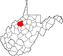 | |
| Towns | ||
| Unincorporated communities |
| |
| Ghost towns | ||
| Footnotes | ‡This populated place also has portions in an adjacent county or counties | |
This article is issued from
Wikipedia.
The text is licensed under Creative Commons - Attribution - Sharealike.
Additional terms may apply for the media files.