Pencoed
| Pencoed | |
|---|---|
 | |
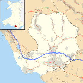 Pencoed Pencoed shown within Bridgend | |
| Population | 9,166 [1] |
| OS grid reference | SS957815 |
| Principal area | |
| Ceremonial county | |
| Country | Wales |
| Sovereign state | United Kingdom |
| Post town | BRIDGEND |
| Postcode district | CF35 |
| Dialling code | 01656 |
| Police | South Wales |
| Fire | South Wales |
| Ambulance | Welsh |
| EU Parliament | Wales |
| UK Parliament | |
Pencoed is a heavily urbanised community and town in the county borough of Bridgend, Wales. It straddles the M4 motorway north east of Bridgend and is situated on the Ewenny River. As of the 2011 census it had a population of around 9,170.
Early habitation
The earliest evidence of habitation in the area is the nearby Ogof y Pebyll ("Tents Cave") or Ogof Coed-y-Mwstwr ("Hubbub Wood Cave")),(51°30′57″N 3°30′47″W / 51.5159°N 3.5131°W, Grid Ref: SS951807) which is a scheduled monument and appears to have been inhabited during Neolithic or Bronze Age periods. Worked flint flakes have been found, along with the teeth of numerous mammals of many different species.[2]
Etymology
According to Morgan Thomas, writing in 1887, the name Pencoed in its simplest terms means head (pen) of the woods (coed); top of the woods.[3]
The correct pronunciation of the name Pencoed is a cause of some argument within the town. The English approximation of the standard Welsh pronunciation of the name is /ˈpɛnkɔɪd/ PEN-koyd, though many locals pronounce it /ˈpɛnkɔːd/ PEN-kawd or /ˈpɛnkoʊd/ PEN-kohd, reflecting the usual pronunciation of the digraph oe in the southern dialects of Welsh.
Present town
Pencoed as a town developed in the late 19th century, around the coal mining industry; the coal mines have now closed.
The town is in the Ewenny Valley and is divided by the M4 motorway near Junction 35, although almost all of the town lies to the north of the M4. About two miles north of the town, the upland relief of the South Wales Valleys starts. To the south are the rolling countryside of the Vale of Glamorgan and the rugged north coast of the Bristol Channel.
The town consists of three distinct areas, which were once four small hamlets. To the north is Penprysg ("copse end"), which lies at the end of the low ridge (100 m) of Cefn Hirgoed ("long wood ridge"). To the west is Hendre ("old settlement") which rises gently from the railway line in the centre of the town towards the common land at Ystradwaun ("level moor"). The central and eastern part of the town, which lies on the valley floor near the railway, consists of Pencoed itself and Felindre ("Mill Town"). There are numerous streams rising and running through the town, and two main rivers, the Ewenni Fawr (Great Ewenny) and the Ewenni Fach (Little Ewenny). At the centre of the town, close to the station, is the war memorial (known locally as the Monument), the shopping centre and the local Community Hall (Pencoed Miners' Welfare Hall). The town is well provided with sports facilities, schools, pubs and clubs. A new development, 'Earlswood Parc', was announced in 2002 and now has been completed, incorporating various 'Westbury' built homes and Bocam business park.
The current Mayor is Councillor John McCarthy.
Pencoed hosted the National Eisteddfod in 1998.
The Raspberry Pi basic computer is manufactured at the Sony Technology Centre in Pencoed, which produces 44,000 every week.[4]
Twinning
Pencoed has twinning arrangements with:
References
- ↑ "Town population 2011". Retrieved 7 November 2015.
- ↑ Coflein.gov.uk NPRN: 307635. Glamorgan-Gwent Archaeological Trust (search for PRN: 00384m). Cadw SAM: GM434: Ogof y Pebyll Cave
- ↑ Morgan, Thomas (1887). The Place Names of Wales. p. 194.
- ↑ www.sony.co.uk
External links
- Pencoed Town Council website
- www.geograph.co.uk : photos of Pencoed and surrounding area
- 2426 (Pencoed) Squadron - Air Training Corp
| Communities | 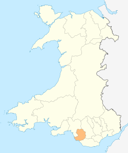 | |
|---|---|---|
| Towns and villages |
| |
| Castles | ||
| Rivers | ||
| Topics | ||
- www.pencoedunited.co.uk