Pegnitz (town)
| Pegnitz | ||
|---|---|---|
| ||
 Pegnitz Location of Pegnitz within Bayreuth district 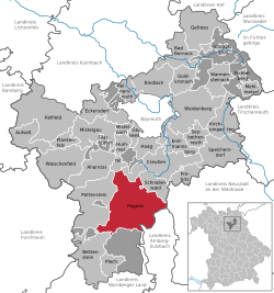 | ||
| Coordinates: 49°45′23″N 11°32′42″E / 49.75639°N 11.54500°ECoordinates: 49°45′23″N 11°32′42″E / 49.75639°N 11.54500°E | ||
| Country | Germany | |
| State | Bavaria | |
| Admin. region | Oberfranken | |
| District | Bayreuth | |
| Government | ||
| • Mayor | Uwe Raab (SPD) | |
| Area | ||
| • Total | 100.03 km2 (38.62 sq mi) | |
| Elevation | 422 m (1,385 ft) | |
| Population (2017-12-31)[1] | ||
| • Total | 13,290 | |
| • Density | 130/km2 (340/sq mi) | |
| Time zone | CET/CEST (UTC+1/+2) | |
| Postal codes | 91257 | |
| Dialling codes | 09241 | |
| Vehicle registration | BT, EBS, ESB, KEM, MÜB, PEG | |
| Website | www.pegnitz.de | |

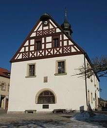
Old town hall
Pegnitz is a town in the Bayreuth district in Upper Franconia, Bavaria, Germany, with a population of approximately 15,000 inhabitants. It is also the source of the river Pegnitz. The city Bayreuth is about 27 km to the north.
The villages (Ortsteile) in Pegnitz are:
|
|
|
|
Annual events are the Christmas market, the Open-Air Rock Festival Waldstock, and above all, the seasonal strong-beer festival called Flinderer.
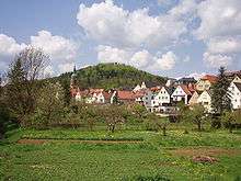 Pegnitz, with St. Bartholomäus on the left and castle hill in the background. |
 The 1923 observation tower |
References
- ↑ "Fortschreibung des Bevölkerungsstandes". Bayerisches Landesamt für Statistik und Datenverarbeitung (in German). September 2018.
This article is issued from
Wikipedia.
The text is licensed under Creative Commons - Attribution - Sharealike.
Additional terms may apply for the media files.