Parappur
| Parappoor പറപ്പൂര് | |
|---|---|
| village | |
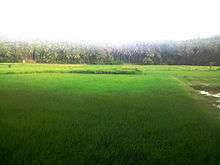
 Paddy fields in parappur | |
| Coordinates: 11°02′01″N 76°00′00″E / 11.0335300°N 76.000100°ECoordinates: 11°02′01″N 76°00′00″E / 11.0335300°N 76.000100°E | |
| Country |
|
| State | Kerala |
| District | Malappuram |
| Area | |
| • Total | 15.11 km2 (5.83 sq mi) |
| Elevation | 45 m (148 ft) |
| Population (2011) | |
| • Total | 36,270 |
| • Density | 2,400/km2 (6,000/sq mi) |
| Languages | |
| • Official | Malayalam, English |
| Time zone | UTC+5:30 (IST) |
| PIN | 676503 |
| Telephone code | 0483 |
| Vehicle registration | KL-65 |
| Nearest city | Malappuram |
| Sex ratio | 1062 ♂/♀ |
| Literacy | 91.45% |
| Lok Sabha constituency | Malappuram |
| Vidhan Sabha constituency | Vengara |
| Website |
lsgkerala |

Parappur is a village in Malappuram district in the state of Kerala, India.[1]
Geography
The village has an area of 15.11 km2 (4,473 sq mi) and is bordered by Vengara, Ooragam and Othukkungal villages to the north and Othukkungal village to the east, Edarikkod and Kottakkal villages to the south and the Edarikkod and Vengara towards the west.
Demographics
As of 2011 India census, Parappur had a population of 36270 with 16975 males and 19295 females.[1]
Culture
Parappur village is a predominantly Muslim populated area. Hindus are exist in comparatively smaller numbers. Duff Muttu, Kolkali and Aravanamuttu are common folk arts of this locality. There are many libraries attached to mosques giving a rich source of Islamic studies. Some of the books are written in Arabi-Malayalam which is a version of the Malayalam language written in Arabic script. Business and family issues are also sorted out during these evening meetings. The Hindu minority of this area keeps their rich traditions by celebrating various festivals in their temples. Hindu rituals are done here with a regular devotion like other parts of Kerala.[2]
Transportation
Parappur village connects to other parts of India through Kottakkal town. National highway No.66 passes through Tanur and the northern stretch connects to Goa and Mumbai. The southern stretch connects to Cochin and Trivandrum. State Highway No.28 starts from Nilambur and connects to Ooty, Mysore and Bangalore through Highways.12,29 and 181. National Highway No.966 connects to Palakkad and Coimbatore. The nearest airport is at Kozhikode. The nearest major railway station is at Tirur.
References
| Wikimedia Commons has media related to Parappur. |
- 1 2 Registrar General & Census Commissioner, India. "Census of India : Villages with population 5000 & above". Retrieved 2008-12-10.
- ↑ "Archived copy". Archived from the original on 2016-04-01. Retrieved 2016-07-14.