Kinglake West, Victoria
| Kinglake West Victoria | |||||||||||||||
|---|---|---|---|---|---|---|---|---|---|---|---|---|---|---|---|
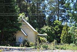 Uniting church | |||||||||||||||
 Kinglake West | |||||||||||||||
| Coordinates | 37°28′S 145°14′E / 37.467°S 145.233°ECoordinates: 37°28′S 145°14′E / 37.467°S 145.233°E | ||||||||||||||
| Population | 1,166 (2016)[1] | ||||||||||||||
| Postcode(s) | 3757 | ||||||||||||||
| Location | 48 km (30 mi) N of Melbourne | ||||||||||||||
| LGA(s) | |||||||||||||||
| State electorate(s) | |||||||||||||||
| Federal Division(s) | |||||||||||||||
| |||||||||||||||
Kinglake West is a town in central Victoria, Australia. The town is located 56 kilometres (35 mi) north-east of the state capital, Melbourne. Its local government area is the City of Whittlesea and the Shires of Murrindindi and Nillumbik. At the 2016 Census, Kinglake West had a population of 1,166.
The town was substantially damaged in the Black Saturday bushfires, including 10 fatalities.[2]
Kinglake West Post Office opened around 1902 and burnt down on 7 February 2009.[3]
References
| Wikimedia Commons has media related to Kinglake West, Victoria. |
- ↑ Australian Bureau of Statistics (27 June 2017). "Kinglake West (State Suburb)". 2016 Census QuickStats. Retrieved 2017-07-03.

- ↑ "Wiped out: Towns destroyed by killer fires". ABC News. Australian Broadcasting Corporation. Retrieved 2009-02-07.
- ↑ Premier Postal History. "Post Office List". Retrieved 2008-04-11.
This article is issued from
Wikipedia.
The text is licensed under Creative Commons - Attribution - Sharealike.
Additional terms may apply for the media files.