Panther Creek Township, Cass County, Illinois
| Panther Creek Township | |
|---|---|
| Township | |
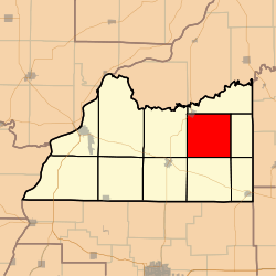 Location in Cass County | |
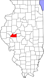 Cass County's location in Illinois | |
| Coordinates: 40°00′10″N 90°06′22″W / 40.00278°N 90.10611°WCoordinates: 40°00′10″N 90°06′22″W / 40.00278°N 90.10611°W | |
| Country | United States |
| State | Illinois |
| County | Cass |
| Established | November 6, 1923 |
| Area | |
| • Total | 35.57 sq mi (92.1 km2) |
| • Land | 35.49 sq mi (91.9 km2) |
| • Water | 0.07 sq mi (0.2 km2) 0.20% |
| Elevation | 604 ft (184 m) |
| Population (2010) | |
| • Estimate (2016)[1] | 273 |
| • Density | 8.2/sq mi (3.2/km2) |
| Time zone | UTC-6 (CST) |
| • Summer (DST) | UTC-5 (CDT) |
| ZIP codes | 62627, 62691 |
| FIPS code | 17-017-57550 |
Panther Creek Township is one of eleven townships in Cass County, Illinois, USA. As of the 2010 census, its population was 291 and it contained 148 housing units.[2]
Geography
According to the 2010 census, the township has a total area of 35.57 square miles (92.1 km2), of which 35.49 square miles (91.9 km2) (or 99.78%) is land and 0.07 square miles (0.18 km2) (or 0.20%) is water.[2]
Cities, towns, villages
- Chandlerville (southeast half)
Unincorporated towns
- Anderson
- Palmerton
- Sylvan (historical)
- Panther Creek (historical) It is indicated on an 1839 map as a town that is east of present-day Chandlerville on what is now known as Chandlerville Road. The 1839 road was a sulky road; a sulky is a carriage seating only one person.[3]
(This list is based on USGS data and may include former settlements.)
Cemeteries
The township contains these four cemeteries: Allendale, Bell, Chandlerville City and Pontiac.
Major highways
Landmarks
- Panther Creek Conservation Area (east quarter)
- Panther Creek State Wildlife Refuge
Demographics
| Historical population | |||
|---|---|---|---|
| Census | Pop. | %± | |
| Est. 2016 | 273 | [1] | |
| U.S. Decennial Census[4] | |||
School districts
- A C Central Community Unit School District 262
- Virginia Community Unit School District 64
Political districts
- Illinois' 18th congressional district
- State House District 93
- State Senate District 47
References
- "Panther Creek Township, Cass County, Illinois". Geographic Names Information System. United States Geological Survey. Retrieved 2010-01-04.
- United States Census Bureau 2007 TIGER/Line Shapefiles
- United States National Atlas
- 1 2 "Population and Housing Unit Estimates". Retrieved June 9, 2017.
- 1 2 "Population, Housing Units, Area, and Density: 2010 - County -- County Subdivision and Place -- 2010 Census Summary File 1". United States Census. Retrieved 2013-05-28.
- ↑ https://www.loc.gov/resource/g3700m.gct00185/?sp=14&r=0.586,0.524,0.107,0.046,0/http://www.loc.gov/ Library of Congress. Retrieved June 10, 2018.
- ↑ "Census of Population and Housing". Census.gov. Retrieved June 4, 2016.
External links
Places adjacent to Panther Creek Township, Cass County, Illinois | |
|---|---|
Municipalities and communities of Cass County, Illinois, United States | ||
|---|---|---|
| Cities | ||
| Villages | ||
| Townships | ||
| Unincorporated communities | ||
| Ghost towns | ||
This article is issued from
Wikipedia.
The text is licensed under Creative Commons - Attribution - Sharealike.
Additional terms may apply for the media files.