Hagener Township, Cass County, Illinois
| Hagener Township | |
|---|---|
| Township | |
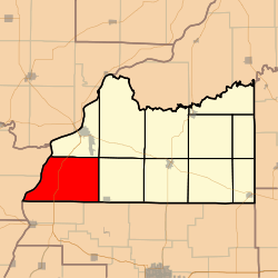 Location in Cass County | |
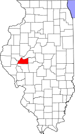 Cass County's location in Illinois | |
| Coordinates: 39°55′15″N 90°27′42″W / 39.92083°N 90.46167°WCoordinates: 39°55′15″N 90°27′42″W / 39.92083°N 90.46167°W | |
| Country | United States |
| State | Illinois |
| County | Cass |
| Established | November 6, 1923 |
| Area | |
| • Total | 49.75 sq mi (128.9 km2) |
| • Land | 47.95 sq mi (124.2 km2) |
| • Water | 1.8 sq mi (5 km2) 3.62% |
| Elevation | 453 ft (138 m) |
| Population (2010) | |
| • Estimate (2016)[1] | 356 |
| • Density | 7.9/sq mi (3.1/km2) |
| Time zone | UTC-6 (CST) |
| • Summer (DST) | UTC-5 (CDT) |
| ZIP codes | 62611, 62618 |
| FIPS code | 17-017-32148 |
Hagener Township is one of eleven townships in Cass County, Illinois, USA. As of the 2010 census, its population was 381 and it contained 163 housing units.[2]
Geography
According to the 2010 census, the township has a total area of 49.75 square miles (128.9 km2), of which 47.95 square miles (124.2 km2) (or 96.38%) is land and 1.8 square miles (4.7 km2) (or 3.62%) is water.[2]
Unincorporated towns
(This list is based on USGS data and may include former settlements.)
Cemeteries
The township contains these seven cemeteries: Black Oak, Bush, Hackman, Immanuel Lutheran, Saint Peters Lutheran, Schneider and Wagle.
Major highways
Airports and landing strips
- Kinsey RLA Airport
- Kloker Airport
- Phillip H Krohe Airport
Rivers
Lakes
- Meredosia Lake
Demographics
| Historical population | |||
|---|---|---|---|
| Census | Pop. | %± | |
| Est. 2016 | 356 | [1] | |
| U.S. Decennial Census[3] | |||
School districts
- Beardstown Community Unit School District 15
- Meredosia-Chambersburg Community Unit School District 11
- Triopia Community Unit School District 27
Political districts
- Illinois' 18th congressional district
- State House District 93
- State Senate District 47
References
- "Hagener Township, Cass County, Illinois". Geographic Names Information System. United States Geological Survey. Retrieved 2010-01-04.
- United States Census Bureau 2007 TIGER/Line Shapefiles
- United States National Atlas
- 1 2 "Population and Housing Unit Estimates". Retrieved June 9, 2017.
- 1 2 "Population, Housing Units, Area, and Density: 2010 - County -- County Subdivision and Place -- 2010 Census Summary File 1". United States Census. Retrieved 2013-05-28.
- ↑ "Census of Population and Housing". Census.gov. Retrieved June 4, 2016.
External links
Places adjacent to Hagener Township, Cass County, Illinois | |
|---|---|
Municipalities and communities of Cass County, Illinois, United States | ||
|---|---|---|
| Cities | ||
| Villages | ||
| Townships | ||
| Unincorporated communities | ||
| Ghost towns | ||
This article is issued from
Wikipedia.
The text is licensed under Creative Commons - Attribution - Sharealike.
Additional terms may apply for the media files.