Pallippuram, Thiruvananthapuram
| Pallippuram | |
|---|---|
| suburb | |
 Pallippuram Location in Kerala, India  Pallippuram Pallippuram (India) | |
| Coordinates: 8°36′0″N 76°51′0″E / 8.60000°N 76.85000°ECoordinates: 8°36′0″N 76°51′0″E / 8.60000°N 76.85000°E | |
| Country |
|
| State | Kerala |
| District | Thiruvananthapuram |
| Government | |
| • Body | Gram panchayat |
| Languages | |
| • Official | Malayalam, English |
| Time zone | UTC+5:30 (IST) |
| PIN | 695316 |
| Vehicle registration | KL- 22, KL-01 |
| Coastline | 0 kilometres (0 mi) |
| Nearest city | Attingal |
Pallippuram is a northern suburb of Trivandrum city of Trivandrum district, Kerala. It is one of the fastest urbanising area of the Trivandrum UA.Technocity is situated in this area.
Geography
It is located at 8°36′0″N 76°51′0″E / 8.60000°N 76.85000°E.[1]
Location
Pallippuram is located on National Highway 47, 7 km north of Kazhakkoottam.
Nearest airport is Thiruvananthapuram International Airport and nearest major railway station is Thiruvananthapuram Central. It is well connected to Thiruvananthapuram city by state road transport buses.
The headquarters of the Central Reserve Police Force(CRPF) camp in Kerala is at Pallippuram. Another CRPF camp is in Peringome, Payyannur. The IG of the camp is K.V. Madhusudhanan==.
References
- ↑ http://wikimapia.org/173795/Cpf-Pallippuram Wikimapia
External links
District HQ: Thiruvananthapuram | |||||||
| History | 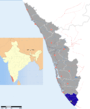 | ||||||
| Geography | |||||||
| Cities and Taluks |
| ||||||
| Transport | |||||||
| Education |
| ||||||
| Buildings | |||||||
| Culture | |||||||
| Lok Sabha constituencies | |||||||
| Sports | |||||||
| Museums | |||||||
This article is issued from
Wikipedia.
The text is licensed under Creative Commons - Attribution - Sharealike.
Additional terms may apply for the media files.