Paletwa
| Platwa alangvum | |
|---|---|
| Town | |
 Platwa Location in Burma | |
| Coordinates: 21°18′N 92°51′E / 21.300°N 92.850°ECoordinates: 21°18′N 92°51′E / 21.300°N 92.850°E | |
| Country |
|
| Division |
|
| District | Mindat District |
| Township | Paletwa Township |
| Area | |
| • Total | 1,368 sq mi (3,543 km2) |
| Population (The most populated in Chin State) | 96,899 |
| Time zone | UTC+6.30 (MST) |
| Climate | Am |
Platwa[1] (Palangvum) is one of the westernmost towns of Myanmar, in Chin State 18 kilometres from the border with Bangladesh. It is the administrative seat for Platwa Township. Before British period, Paletwa was one of the parts of Arakan Kingdom.During British periods, Platwa became the region of Arakan hill tract.But in the U Nu administration, he added it in to the Chin State.Now,Platwa Township (Palangvum Kapeang) is a township of Mindat District in the Chin State of Myanmar.
The population of it was 96,899 according to an answer in Myanmar parliament on 14 May 2014.[2]
References
External links
Capital: Paletwa | |
|
Capital: Hakha | ||
| Falam District | 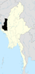 | |
| Hakha District | ||
| Matupi District | ||
| Mindat District | ||
| Cities and towns | ||
This article is issued from
Wikipedia.
The text is licensed under Creative Commons - Attribution - Sharealike.
Additional terms may apply for the media files.