Pakutia Union
| Pakutia Union পাকুটিয়া ইউনিয়ন | |
|---|---|
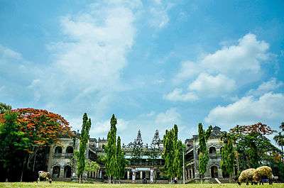 Pakutia Rajbari | |
 Pakutia Union Location of Pakutia in Bangladesh | |
| Coordinates: 24°01′15″N 89°59′13″E / 24.020717864792935°N 89.98706370592117°ECoordinates: 24°01′15″N 89°59′13″E / 24.020717864792935°N 89.98706370592117°E | |
| Country | Bangladesh |
| Division | Dhaka Division |
| District | Tangail District |
| Upazila | Nagarpur Upazila |
| Established on | 1984 |
| Government | |
| • Type | Union Council |
| • Chairman | Siddiqur Rahman(Bangladesh Nationalist Party) |
| Area | |
| • Total | 17.39 km2 (6.71 sq mi) |
| Elevation | 15 m (49 ft) |
| Population (2011) | |
| • Total | 18,184 |
| • Density | 1,000/km2 (2,700/sq mi) |
| Time zone | UTC+6 (BST) |
| Postal code | 1936 |
| Website | Official Website of Pakutia Union |
Pakutia Union (Bengali: পাকুটিয়া ইউনিয়ন) is a union of Nagarpur Upazila, Tangail District, Bangladesh. It is situated 40 km southeast of Tangail city and 64 km northwest of Dhaka, The capital of Bangladesh.
Demographics
According to Population Census 2011 performed by Bangladesh Bureau of Statistics, The total population of Pakutia union is 18,184 .There are households 4,290 in total.[1]
See also
References
- ↑ "Tangail Table C-01 : Area, Households, Population, Density by Residence and Community" (PDF). bbs.gov.bd. Archived from the original (PDF) on 2014-11-13. Retrieved 2016-03-01.
This article is issued from
Wikipedia.
The text is licensed under Creative Commons - Attribution - Sharealike.
Additional terms may apply for the media files.