Paint Rock, North Carolina
| Paint Rock | |
|---|---|
| Unincorporated community | |
 Paint Rock Location within the state of North Carolina | |
| Coordinates: 35°55′50″N 82°53′23″W / 35.93056°N 82.88972°WCoordinates: 35°55′50″N 82°53′23″W / 35.93056°N 82.88972°W | |
| Country | United States |
| State | North Carolina |
| County | Madison County |
| Elevation | 1,266 ft (386 m) |
| Time zone | UTC-5 (Eastern (EST)) |
| • Summer (DST) | UTC-4 (EDT) |
| ZIP code | 28743 |
| Area code(s) | 828 |
| GNIS feature ID | 1021780[1] |
Paint Rock is an unincorporated community in Madison County, North Carolina, United States. The community is named after the nearby mountain of the same name along the North Carolina–Tennessee state line. Located along the south banks of the French Broad River, the community is accessible via Paint Rock Road (SR 1300), which connects to US 25/US 70. The Norfolk Southern S-Line also travels through the community.[2] The community is part of the Asheville Metropolitan Statistical Area.
References
- ↑ U.S. Geological Survey Geographic Names Information System: Paint Rock, North Carolina
- ↑ Madison County, North Carolina (PDF) (Map). Cartography by NCDOT. Raleigh: North Carolina Department of Transportation. September 2015. Enlarged Municipal and Suburban Areas inset. Retrieved April 7, 2016.
Municipalities and communities of Madison County, North Carolina, United States | ||
|---|---|---|
| Towns | 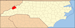 | |
| Unincorporated communities | ||
This article is issued from
Wikipedia.
The text is licensed under Creative Commons - Attribution - Sharealike.
Additional terms may apply for the media files.