Pabbo
| Pabbo | |
|---|---|
| Municipality | |
 Pabbo Location in Uganda | |
| Coordinates: 03°00′00″N 32°08′42″E / 3.00000°N 32.14500°E | |
| Country |
|
| Region | Northern Region of Uganda |
| Sub-region | Acholi sub-region |
| Districts of Uganda | Amuru District |
| Elevation | 3,150 ft (960 m) |
Pabbo, sometimes spelled as Pabo, is a municipality in Amuru District of the Northern Region of Uganda.
Location
Pabbo is on the Gulu-Nimule Road, the main highway (A-104) between Gulu and the border with Southern Sudan at Nimule. Pabbo is approximately 39 kilometres (24 mi), by road, north of Gulu, the largest city in the Acholi sub-region.[1] Its location is approximately 375 kilometres (233 mi), by road, north of Kampala, the capital and largest city of Uganda.[2] The coordinates of the town are 03 00 00N, 32 08 42E (Latitude:3.0000; Longitude:32.1450).[3]
Overview
During the Lord's Resistance Army war (1986 - 2006), Pabbo was the site of one of the largest camps for internally displaced people, swelling to over 67,000 in 2005.[4] Since the cessation of hostilities in 2006, some of those people have returned to their villages.[5][6]
Points of interest
The following points of interest lie within the town limits or close to its edges:
- offices of Pabbo Town Council
- Pabbo central market
- Gulu-Nimule Road, passing through town in a north/south direction.[7]
See also
References
- ↑ GFC. "Road Distance Between Pabbo And Gulu With Map". Globefeed.com (GFC). Retrieved 23 July 2015.
- ↑ GFC. "Road Distance Between Pabbo And Kampala With Map". Globefeed.com (GFC). Retrieved 23 July 2015.
- ↑ Google (23 July 2015). "Location of Pabbo At Google Maps" (Map). Google Maps. Google. Retrieved 23 July 2015.
- ↑ UNICEF (15 June 2005). "Study Highlights Rape In Northern Uganda's Largest IDP Camp". United Nations Children’s Fund (UNICEF). Retrieved 23 July 2015.
- ↑ Jaramogi, Patrick (19 April 2006). "10,000 Leave Pabbo Camp". New Vision. Kampala. Retrieved 23 July 2015.
- ↑ Klein, Alice (24 January 2012). "Northern Uganda's Displaced People Are Left To Fend For Themselves". The Guardian. London. Retrieved 23 July 2015.
- ↑ Jeff Lule, and Cecilia Okoth (28 March 2010). "Japan And World Bank Will Finance Upgrade of Gulu-Nimule Road". New Vision. Kampala. Archived from the original on 3 September 2014. Retrieved 23 July 2015.
External links
Capital: Amuru | ||
| Towns and villages | 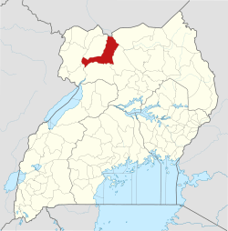 | |
| Geography |
| |
| Economy | ||
| Transport | ||
| Notable people | ||