Otermanjärvi
| Otermanjärvi | |
|---|---|
 | |
| Location | Vaala |
| Coordinates | 64°39′N 027°05′E / 64.650°N 27.083°ECoordinates: 64°39′N 027°05′E / 64.650°N 27.083°E |
| Type | Lake |
| Catchment area | Oulujoki |
| Basin countries | Finland |
| Surface area | 21.124 km2 (8.156 sq mi) |
| Average depth | 2 m (6 ft 7 in) |
| Max. depth | 5.47 m (17.9 ft) |
| Water volume | 0.0422 km3 (34,200 acre⋅ft) |
| Shore length1 | 52.46 km (32.60 mi) |
| Surface elevation | 140.6 m (461 ft) |
| Frozen | December–April |
| Islands | Holapansaari |
| References | [1] |
| 1 Shore length is not a well-defined measure. | |
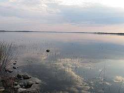
Otermanjärvi is a medium-sized lake in Vaala municipality, in Finland. It belongs to the Oulujoki main catchment area.[1]
See also
References
- 1 2 Otermanjärvi in the Jarviwiki Web Service. Retrieved 2014-03-04. (in English)
External links

This article is issued from
Wikipedia.
The text is licensed under Creative Commons - Attribution - Sharealike.
Additional terms may apply for the media files.