Osh Region
| Osh Region Ош облусу Ошская область | |||
|---|---|---|---|
| Region | |||
| |||
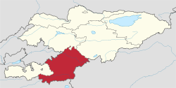 Map of Kyrgyzstan, location of Osh Region highlighted | |||
| Coordinates: 40°0′N 73°0′E / 40.000°N 73.000°ECoordinates: 40°0′N 73°0′E / 40.000°N 73.000°E | |||
| Country |
| ||
| Capital | Osh | ||
| Government | |||
| • Gubernator | Sooronbay Jeenbekov | ||
| Area | |||
| • Total | 28,934 km2 (11,171 sq mi) | ||
| Population (2009-01-01)[1] | |||
| • Total | 999,576 | ||
| • Density | 35/km2 (89/sq mi) | ||
| Time zone | UTC+6 (East) | ||
| • Summer (DST) | UTC+6 (not observed) | ||
| ISO 3166 code | KG-O | ||
| Districts | 8 | ||
| Cities | 3 | ||
| Townships | 2 | ||
| Villages | 474 | ||


Osh Region (Kyrgyz: Ош облусу, Oş oblusu/Osh oblusu, وش وبلاستى; Russian: Ошская область, Oshskaya oblast’/Ošskaja oblastj) is a region (oblast) of Kyrgyzstan. Its capital is Osh. It is bounded by (clockwise) Jalal-Abad Region, Naryn Region, Xinjiang, China, Tajikistan, Batken Region, and Uzbekistan.
Geography
Most of the population lives in the flat northern part of the Oblast, on the edge of the Ferghana Valley. The land gradually rises southward to the crest of the Alay Mountains, drops into the Alay Valley and rises to the Trans-Alai Range which forms the border with Tajikistan. In the east, the land rises to the Ferghana Range which is roughly parallel to the Naryn border. This area is drained by the Kara Darya which flows northwest to join the Naryn River to form the Syr Darya in the Ferghana Valley.
Highway M41 goes south over the mountains from Osh to the Tajik border. At Sary-Tash a branch goes east to the Chinese border crossing at Irkeshtam. The other main road goes west through the flat country to Batken Region.
Demographics
As of 2009, Osh Region (excluding Osh) comprised 3 towns (Nookat, Uzgen, and Kara-Suu), 2 urban-type settlement and 474 villages. Its de facto population, according to the Population and Housing Census of 2009, was 999,576. Of them, 82,841 people live in urban areas, and 916,735 in rural ones.
More than half of all Kyrgyzstan's Uzbeks live in Osh Region. They are 28% of the regional population according to the 2009 census.[1]
| Historical populations in Osh Region | ||
|---|---|---|
| Year | Pop. | ±% |
| 1970 | 433,036 | — |
| 1979 | 552,843 | +27.7% |
| 1989 | 716,983 | +29.7% |
| 1999 | 940,633 | +31.2% |
| 2009 | 999,576 | +6.3% |
| Note: enumerated de facto population; Source:[1] | ||
Ethnic composition
According to the 2009 Census, the ethnic composition of the Osh Region (de jure population) was:[1]
| Ethnic group | Population | Proportion of population |
|---|---|---|
| Kyrgyzs | 758,036 | 68.6% |
| Uzbeks | 308,688 | 28.0% |
| Uygurs | 11,181 | 1% |
| Turks | 10,934 | 1% |
| Tajiks | 6,711 | 0.6% |
| Azerbaijanis | 3,224 | 0.3% |
| Russians | 1,552 | 0.1% |
| Tatars | 1,337 | 0.1% |
| Dungans | 793 | 0.1% |
| other groups | 1,792 | 0.2% |
Districts
Osh Region is divided administratively into 7 districts (listed counter-clockwise):[2]
| District | Capital | Location |
|---|---|---|
| Uzgen District | Uzgen | North1 |
| Kara-Suu District | Kara-Suu | North2 |
| Aravan District | Aravan | North3 |
| Nookat District | Eski-Nookat | West |
| Chong-Alay District | Daroot-Korgon | Southwest |
| Alay District | Gul'cha | Southeast |
| Kara-Kulja District | Kara-Kulja | East |
Enclaves and exclaves
Kyrgyzstan's only exclave within Uzbekistan is administratively part of Osh Region (Kara-Suu District). This is the tiny village of Barak (population 627) in the Fergana valley, located on the road from Osh (Kyrgyzstan) to Khodjaabad (Uzbekistan) about 4 km north-west from the Kyrgyz–Uzbek border in the direction of Andijan.[3]
See also
References
- 1 2 3 4 Population and Housing Census 2009. Book 3 (in tables). Regions of Kyrgyzstan: Osh Region (Перепись населения и жилищного фонда Кыргызской Республики 2009. Книга 3 (в таблицах). Регионы Кыргызстана: Ошская область (PDF), Bishkek: National Committee on Statistics, 2010, archived from the original (PDF) on 2011-08-10
- ↑ Kyrgyzstan - Джалал-Абадская область
- ↑ Map showing the location of the Kyrgyz exclave Barak. Retrieved on 2 May 2009
Works cited
- Laurence Mitchell, Kyrgyzstan, Bradt Travel Guides, 2008
Places adjacent to Osh Region | |
|---|---|
| Authority control |
|---|