Ooralea, Queensland
| Ooralea Queensland | |||||||||||||||
|---|---|---|---|---|---|---|---|---|---|---|---|---|---|---|---|
 Ooralea | |||||||||||||||
| Coordinates | 21°10′42″S 149°08′36″E / 21.1783°S 149.1433°ECoordinates: 21°10′42″S 149°08′36″E / 21.1783°S 149.1433°E | ||||||||||||||
| Population | 3,366 (2016 census)[1] | ||||||||||||||
| • Density | 571/km2 (1,478/sq mi) | ||||||||||||||
| Postcode(s) | 4740 | ||||||||||||||
| Area | 5.9 km2 (2.3 sq mi) | ||||||||||||||
| LGA(s) | Mackay Region | ||||||||||||||
| State electorate(s) | Mirani | ||||||||||||||
| Federal Division(s) | Capricornia | ||||||||||||||
| |||||||||||||||
Ooralea is a suburb in the Mackay Region, Queensland, Australia.[2]
Geography
Ooralea is an outer suburb of Mackay. The Peak Downs Highway bounds the suburb to the north and the Bruce Highway bounds the suburb to the east.[3]
Although a suburb, Ooralea is only partially used for residential housing with the rest still used for farming sugarcane.[3] The Mackay Regional Council anticipates further suburban development in this suburb.[4]
The Mackay Harness Racing Club operates the Ooralea Racecourse in the north-east corner of the suburb. A number of streets near the racecourse are named for champion thoroughbreds such as Makybe Diva Drive, Phar Lap Parade, Gunsynd Street and Bernborough Avenue.[3]
Central Queensland University operates a campus at Ooralea bounded by Boundary Road and University Drive.[3]
History
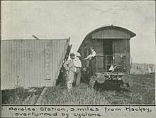
Ooralea was originally known as Planlands after the Planlands railway station on the now defunct Mackay railway line which ran parallel to the Peak Downs Highway. The railway station was opposite the race track (21°09′56″S 149°08′47″E / 21.165625°S 149.146391°E); it no longer exists.[4][5]
References
- ↑ Australian Bureau of Statistics (27 June 2017). "Ooralea (State Suburb)". 2016 Census QuickStats. Retrieved 18 April 2018.

- ↑ "Ooralea - suburb in Mackay Region (entry 49126)". Queensland Place Names. Queensland Government. Retrieved 6 August 2017.
- 1 2 3 4 "Queensland Globe". State of Queensland. Retrieved 8 August 2017.
- 1 2 "Ooralea (Planlands)". Mackay Regional Council. Archived from the original on 8 August 2017. Retrieved 8 August 2017.
- ↑ "Ooralea". Queensland Places. Centre for the Government of Queensland, University of Queensland. Retrieved 8 August 2017.
External links
| Wikimedia Commons has media related to Ooralea, Queensland. |
- "Ooralea". Queensland Places. Centre for the Government of Queensland, University of Queensland.