Ogoy Island
 Ogoy Island | |
 | |
| Geography | |
|---|---|
| Location | Lake Baikal |
| Length | 2.9 km (1.8 mi) |
| Width | 0.6 km (0.37 mi) |
| Highest elevation | 512 m (1,680 ft) |
| Administration | |
| district | Siberia |
| subject | Irkutsk Oblast |
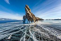
Ogoy (Russian: Ого́й from Buryat: Уhагγй - waterless) is the largest island in the Maloe More strait of Lake Baikal. It has an elongated shape, 2.9 km (1.8 mi) in length and 0.6 km (0.37 mi) in width. It is located between the Cape Shara-Shulun on the west coast of the Olkhon Island and Kurminskiy Bay on the western shore of Lake Baikal. The island is uninhabited.
Wildlife and vegetation
The vegetation is scarce, mainly represented by grasses and low-growing shrubs. In the widest central part of the island separate larches grow. The wildlife is represented by ground squirrels, pikas, snakes. Larks and herring gulls are nesting.
 Northern part of Ogoy
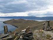 Southern part of Ogoy
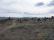 The landscape of Ogoy
Places of interest
In 2005, at the highest point of the island, the Buddhist Stupa of Enlightenment dedicated to Dakini Tröma Nagmo[1] was built at the initiative of the Moscow Buddhist Center. This significantly increased the flow of tourists to the island. In summer, excursions on the boats are organized and in winter, via automobile transport by ice.
According to representatives of the Siberian Institute of Physiology and Biochemistry of Plants, the increase of tourist flow can be detrimental to flora and fauna of the island.[2]
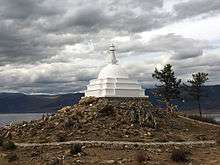
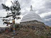
Buddhist Stupa at Ogoy
References
- ↑ a Vajrayana Tibetan Buddhist yidam found in the Chöd lineages
- ↑ "SIFIBR RAS scientific expedition of revegetation around the Buddhist stupa on the island Ogoy (Olkhon district) ended this week" (in Russian). baikaliya.info. Retrieved 2015-11-01.
Coordinates: 53°7′43″N 106°59′56″E / 53.12861°N 106.99889°E