Oberstaufen
| Oberstaufen | ||
|---|---|---|
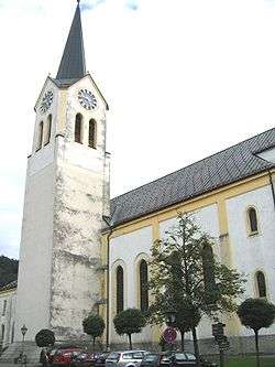 Saint Peter and Paul Church | ||
| ||
 Oberstaufen Location of Oberstaufen within Oberallgäu district 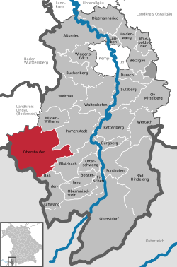 | ||
| Coordinates: 47°33′N 10°1′E / 47.550°N 10.017°ECoordinates: 47°33′N 10°1′E / 47.550°N 10.017°E | ||
| Country | Germany | |
| State | Bavaria | |
| Admin. region | Schwaben | |
| District | Oberallgäu | |
| Government | ||
| • Mayor | Walter Grath | |
| Area | ||
| • Total | 125.84 km2 (48.59 sq mi) | |
| Elevation | 791 m (2,595 ft) | |
| Population (2017-12-31)[1] | ||
| • Total | 7,696 | |
| • Density | 61/km2 (160/sq mi) | |
| Time zone | CET/CEST (UTC+1/+2) | |
| Postal codes | 87534 | |
| Dialling codes | 08386 | |
| Vehicle registration | OA | |
| Website | www.oberstaufen.info | |

Oberstaufen is a municipality in the district of Oberallgäu in Bavarian Swabia, Germany, situated on the B 308 road from Lindau to Immenstadt.
History
It is first mentioned as Stoufun in AD 868. Historically in Swabia (Alemannia), it became part of Bavaria in 1805 with the Peace of Pressburg.
As a result of a marketing campaign by the Oberstaufen tourism industry, Oberstaufen became the first German town for which Google Street View was made available on November 2, 2010.
Activities
- Swim and Sauna in Aquaria
- 6 tennis courts
- 2 Golf Courses
References
- ↑ "Fortschreibung des Bevölkerungsstandes". Bayerisches Landesamt für Statistik und Datenverarbeitung (in German). September 2018.
This article is issued from
Wikipedia.
The text is licensed under Creative Commons - Attribution - Sharealike.
Additional terms may apply for the media files.