Nybyen
Coordinates: 78°12′N 15°35′E / 78.2°N 15.59°E
| Nybyen | |
|---|---|
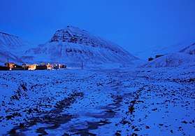
.jpg) Nybyen, looking down the valley to Longyearbyen and the Adventfjorden | |
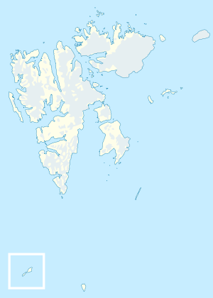 Nybyen Location in western Svalbard | |
| Coordinates: 78°12′0″N 15°34′0″E / 78.20000°N 15.56667°E | |
| Sovereign state | Norway |
| Territory | Svalbard |
| Island | Spitsbergen |
| Community | Longyearbyen |
| Founded | 1946-7 |
| Elevation | 100 m (300 ft) |
| Population (2017) | |
| • Total | 113[1] |
| Postal address | 9171 Longyearbyen |
Nybyen is a small settlement located on the southern outskirts of Longyearbyen, on the island of Spitsbergen, in the Svalbard archipelago of Norway. The name is Norwegian and translates as The New Town.
History and features
The settlement was founded in 1946-47 for the miners of "mine 2B" (later named Julenissegruva, "Santa Claus Mine"), one of the area's many coal mines. During the second half of the 20th century the "New Town" became a notable part of Longyearbyen, with the town's only shop for a period, though commercial activity has moved back down the valley. Today its character reflects that of Svalbard's more mixed economy (tourism, research and mining) with two guesthouses (Guesthouse 102[2] and Spitsbergen Guesthouse[3]) utilising the former miners' barracks, as well as being home to the Svalbard Art Gallery & Craft Centre,[4] and nearby is the Huset restaurant, club and cinema.[5] Most students at the University Centre in Svalbard (UNIS) live in six renovated mining barracks in Nybyen.[6]
Geography
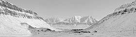
Nybyen is situated in the upper part of the Longyear Valley, about 2.5 kilometres (1.6 mi) uphill from the centre of Longyearbyen, at an altitude of around 100 metres (330 ft).[7]
Nybyen falls within the community of Longyearbyen (incorporated in 2002) though it is somewhat detached from the town. Between the two settlements is the Longyearbyen School. Svalbard Airport is 6 kilometres (3.7 mi) away and there is a shuttle bus between the airport and the guesthouses. To the south, is a prominent hill named Sarkofagen ("Sarcophagus") which rises to 513 metres (1,683 ft).
Sverdrupbyen
To the west, just on the other side of the river, is a place called Sverdrupbyen, named after Einar Sverdrup (1895–1942), the managing director of the mining company Store Norske Spitsbergen Kulkompani.[8] He was the leader of Operation Fritham in World War II, but died in the course of that operation, which attempted to secure Svalbard for the Allies. Nybyen is sometimes alternatively known as Østre Sverdrupbyen ("East Sverdrupbyen").[9] Most buildings in Sverdrupbyen, including those of Mine 1B, were destroyed in a fire rehearsal in the 1980s before they became protected under the cultural heritage preservation law.
References
- ↑ https://www.citypopulation.de/php/norway-oslofjorden-admin.php?adm2id=07060104
- ↑ Guesthouse 102 Archived 2011-06-26 at the Wayback Machine. website
- ↑ Spitsbergen Guesthouse Archived 2011-06-04 at the Wayback Machine. website
- ↑ Svalbard Gallery webpage
- ↑ Huset restaurant website
- ↑ University Centre in Svalbard Archived 2014-08-05 at the Wayback Machine. — Accommodation
- ↑ Svalbard interactive map Archived 2011-07-20 at the Wayback Machine.
- ↑ Cheesemans' Ecology Safaris Archived 2011-09-12 at the Wayback Machine. Walking around Longyearbyen
- ↑ Gezgeen Archived 2012-03-15 at the Wayback Machine. et al.
External links
| Wikimedia Commons has media related to Nybyen. |
- UNIS — Map of Longyearbyen and Nybyen
- Guesthouse 102 — History and information about Nybyen
| General | |
|---|---|
| Politics | |
| Settlements | |
| Former settlements | |
| Environment | |
| Islands | |
| Land areas | |
| National parks | |
| Companies | |
| Research | |
| Telecommunications | |
| Transport | |
| |