Novovolynsk
| Novovolynsk Нововолинськ Nowowołyńsk | |||
|---|---|---|---|
| City of regional significance | |||
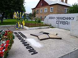 Border Guards monument in Novovolynsk | |||
| |||
 Novovolynsk  Novovolynsk | |||
| Coordinates: 50°44′00″N 24°10′00″E / 50.73333°N 24.16667°E | |||
| Country |
| ||
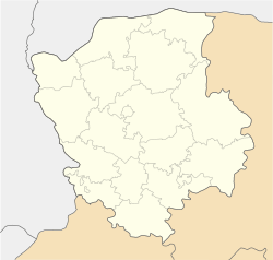
| Oblast |
| ||
| Founded | 1951 | ||
| City status | 1957 | ||
| Government | |||
| • Mayor | Viktor Sapozhnikov | ||
| Area | |||
| • Total | 17 km2 (7 sq mi) | ||
| Population (2018) | |||
| • Total | 52 188[1] | ||
| Postal code | 45400 | ||
| Area code(s) | +380-3344 | ||
| Website |
http://nvip.com.ua/ http://forum.novovolynsk.com.ua/ http://newvol.com.ua/ | ||
Novovolynsk (Ukrainian: Нововолинськ) is a town of oblast significance in Volyn Oblast, Ukraine. Novovolynsk, together with the urban-type settlement of Blahodatne (until 2016 Zhovtneve), is incorporated as Novovolynsk Municipality, an administrative unit of a status equal to that of a district.
Until recenty, Novovolynsk was a major coal mining center of the region. The city has a few factories: a ferroconcrete plant, brickworks, a plant for mining equipment maintenance, a meatpacking and bread factory, and a woodworking plant.
History
Novovolynsk was built in 1950 as a mining town in the USSR. It obtained city status in 1957. The word "Novovolynsk" is a morphological blend, meaning "a new town in the Volyn region".
There is a monument to a famous Ukrainian poet and artist Taras Shevchenko in Novovolynsk. Prominent civil society activist Anna Garmash is also from Novovolynsk, as well as footballer Artem Fedetskyi.
Geography
Novovolynsk is situated in the southwest of Volyn Oblast in the far north-west of Ukraine. The city area is about 17 square kilometers. The state border to Poland runs 15 km to the West from the city; 92 km to the North from Novovolynsk there is the state border to Belarus.
The city is well-situated. The distance to the national highway H22 Ustylug – Lutsk – Rivne is only 18 km. The distance to the international highway E373 (coincides with national M07) Warsaw – Lublin – Kovel – Sarny – Korosten – Kyiv is only 76 km.
Picture Gallery
.jpg)
References
- ↑ Чисельність наявного населення України на 1 січня 2018 року. Державна служба статистики України. Київ, 2018. стор.16
Sources
External links
.jpg)
| Raions | |||||
|---|---|---|---|---|---|
| Cities |
| ||||
| |||||