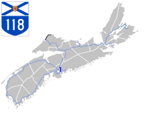
Nova Scotia Highway 118
| ||||
|---|---|---|---|---|
| Lakeview Drive | ||||
 | ||||
| Route information | ||||
| Maintained by Nova Scotia Department of Transportation and Infrastructure Renewal | ||||
| Length | 15.7 km[1][2] (9.8 mi) | |||
| Major junctions | ||||
| South end | Laurier Street in Dartmouth | |||
|
| ||||
| North end |
| |||
| Highway system | ||||
|
Provincial highways in Nova Scotia
| ||||

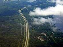
Highway 118, in Nova Scotia, is a short suburban freeway connecting (officially) Victoria Road via Woodland Ave. in Dartmouth with Highway 102 at Fall River, 14 kilometres (8.7 mi) to the north. The highway crosses the Historic Shubenacadie Canal. It also runs along the western shore of Lake Micmac and the western edge of Shubie Park and is known as Lakeview Drive. Running parallel to the highway from the Waverley Road to exit 14 is a portion of the Halifax Lateral of the Maritimes & Northeast Pipeline (natural gas). The highway serves both as a "A-Train and B-Train" route between the Burnside Industrial Park and Highway 102. The highway has the only collector-express section in Atlantic Canada. It is located at the new exit 12 Dartmouth Crossing interchange.
The south end of provincial maintenance is at the Highway 111 interchange.[3]
History
In the early 1970s, it was decided that a new highway was required to directly link Highway 102 with Dartmouth. In 1972, the then Department of Highways expropriated a portion of land for the construction of Highway 118. The highway was completed in the late 1970s.
Exit list
The entire route is located in Halifax Regional Municipality.
| Location | km[1] | mi | Exit | Destinations | Notes | |
|---|---|---|---|---|---|---|
| Dartmouth | −1.3 | −0.81 | At-grade | |||
| 0.0 | 0.0 | Laurier Street | At-grade | |||
| 0.6 | 0.37 | Micmac Boulevard, Lancaster Drive | At-grade, traffic signals | |||
| 1.5 | 0.93 | 11 | Exit 4 on Hwy 111 | |||
| 12 | Southbound exit only; south end of southbound collector/express lane | |||||
| 2.5 | 1.6 | Commodore Drive – Dartmouth Crossing | Southbound exit and entrance | |||
| 3.3 | 2.1 | Wright Avenue – Dartmouth Crossing, Burnside Industrial Park | North end of southbound collector/express lane | |||
| 6.2 | 3.9 | 13 | Signed as exits 13E (east) and 13W (west); exit 13 on Hwy 107 | |||
| Fall River | 15.1 | 9.4 | 14 | Northbound exit, southbound entrance | ||
| 15.7 | 9.8 | Northbound exit, southbound entrance | ||||
1.000 mi = 1.609 km; 1.000 km = 0.621 mi
| ||||||
- Exit 1 was used from 1971 to 2007 and renumbered Exit 11
- Exits 2 and 3 used to be a work site until construction started on Dartmouth Crossing in 2005
- Exit 4 was used until 1979, when it was renumbered to Exit 13
- Exit 5 was also used until 1979, when it was renumbered to Exit 14
References
Route map:
- 1 2 Google (July 16, 2017). "Highway 118 in Nova Scotia" (Map). Google Maps. Google. Retrieved July 16, 2017.
- ↑ Halifax Regional Municipality Atlas ISBN 978-1-55109-641-4 ISBN 1-55109-641-2 Page 10"
- ↑ Halifax Regional Municipality, By-Law No. T-400, as amended July 29, 2000