North Lemmon, North Dakota
| North Lemmon, North Dakota | |
|---|---|
| Unincorporated community | |
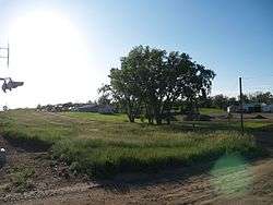 View of North Lemmon from just across the railroad tracks from Lemmon, South Dakota. | |
 Location within the state of North Dakota | |
| Coordinates: 45°56′46″N 102°09′28″W / 45.94611°N 102.15778°WCoordinates: 45°56′46″N 102°09′28″W / 45.94611°N 102.15778°W | |
| Country | United States |
| State | North Dakota |
| County | Adams |
| Named for | George B. Lemmon |
| Elevation[1] | 2,579 ft (786 m) |
| Time zone | UTC-7 (Mountain (MST)) |
| • Summer (DST) | UTC-6 (MDT) |
| ZIP Code | 57638 |
| Area code(s) | 701 |
| FIPS code[2] | 38-57940 |
| GNIS feature ID[2] | 1030466 |
North Lemmon is an unincorporated community in Adams County, North Dakota, United States. A local landowner, George B. Lemmon, is the town's namesake.[3]
History
The community was a station along the Milwaukee Railroad, now served by the BNSF Railway.[4]
Geography
North Lemmon is located at 45°56′46″N 102°09′28″W / 45.94611°N 102.15778°W (45.946112,-102.1576533),[2] just across the South Dakota border from the city of Lemmon, South Dakota. North Lemmon is actually an extension of Lemmon, and includes all of the community that lies in North Dakota.[3] North Lemmon was part of North Lemmon Township, until the township dissolved in 1999.[5] North Lemmon is now included in the Census-designated East Adams Unorganized Territory.
Demographics
The United States Census Bureau does not provide specific population or other demographic information. North Lemmon Township returned a population of 81 as of the 1990 Census,[6] with an estimated population of 66 when the township dissolved in 1999.[7]
References
- ↑ "North Lemmon". Geographic Names Information System. United States Geological Survey.
- 1 2 3 "US Board on Geographic Names". United States Geological Survey. 2007-10-25. Retrieved 2008-01-31.
- 1 2 Wick, Douglas A. North Dakota Place Names. Hedemarken Collectibles. p. 141. ISBN 0-9620968-0-6.
- ↑ "Burlington Northern Santa Fe Railway, Twin Cities Division" (PDF). BNSF Railway. 2006. Retrieved July 19, 2008.
- ↑ "Geographic Change Notes: North Dakota". United States Census Bureau. 2003. Retrieved July 20, 2008.
- ↑ "P001. PERSONS - Universe: Persons, Census 1990 Summary Tape File 1". American Factfinder. <http://factfinder.census.gov>. United States Census Bureau. 2000. Retrieved July 20, 2008.
- ↑ "Population Estimates for Minor Civil Divisions: July 1, 1999 and Population Change: April 1, 1990 to July 1, 1999" (TXT). United States Census Bureau. 2000. Retrieved July 20, 2008.
Municipalities and communities of Adams County, North Dakota, United States | ||
|---|---|---|
| Cities | 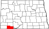 | |
| Townships | ||
| Unorganized territories | ||
| Unincorporated communities | ||