East Adams, North Dakota
| East Adams, North Dakota | |
|---|---|
| Unorganized territory | |
 East Adams | |
| Coordinates: 46°05′49″N 102°16′40″W / 46.09694°N 102.27778°WCoordinates: 46°05′49″N 102°16′40″W / 46.09694°N 102.27778°W | |
| Country | United States |
| State | North Dakota |
| County | Adams |
| Area | |
| • Total | 215.7 sq mi (558.7 km2) |
| • Land | 215.6 sq mi (558.4 km2) |
| • Water | 0.1 sq mi (0.3 km2) |
| Elevation | 2,484 ft (757 m) |
| Population (2010) | |
| • Total | 161 |
| • Density | 0.8/sq mi (0.3/km2) |
| Time zone | UTC-6 (Central (CST)) |
| • Summer (DST) | UTC-5 (CDT) |
| Area code(s) | 701 |
| GNIS feature ID | 1036002[1] |
East Adams is an unorganized territory in Adams County, North Dakota, United States. As of the 2010 census it had a population of 161.[2]
References
- ↑ U.S. Geological Survey Geographic Names Information System: East Adams, North Dakota
- ↑ "Geographic Identifiers: 2010 Demographic Profile Data (G001): East Adams UT, Adams County, North Dakota". U.S. Census Bureau, American Factfinder. Retrieved July 3, 2013.
Municipalities and communities of Adams County, North Dakota, United States | ||
|---|---|---|
| Cities | 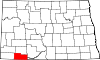 | |
| Townships | ||
| Unorganized territories | ||
| Unincorporated communities | ||
This article is issued from
Wikipedia.
The text is licensed under Creative Commons - Attribution - Sharealike.
Additional terms may apply for the media files.