North Dundas, Ontario
| North Dundas | |
|---|---|
| Township (lower-tier) | |
| Township of North Dundas | |
 North Dundas township office in Winchester | |
 North Dundas | |
| Coordinates: 45°05′N 75°21′W / 45.083°N 75.350°WCoordinates: 45°05′N 75°21′W / 45.083°N 75.350°W | |
| Country |
|
| Province |
|
| County | Stormont, Dundas and Glengarry |
| Formed | January 1, 1998 |
| Government | |
| • Type | Township |
| • Mayor | Eric Duncan |
| • Deputy Mayor | Gerry Boyce |
| • Federal riding | Stormont—Dundas—South Glengarry |
| • Prov. riding | Stormont—Dundas—South Glengarry |
| Area[1] | |
| • Land | 503.21 km2 (194.29 sq mi) |
| Population (2011)[1] | |
| • Total | 11,225 |
| • Density | 22.3/km2 (58/sq mi) |
| Time zone | UTC-5 (Eastern (EST)) |
| • Summer (DST) | UTC-4 (Eastern Daylight (EDT)) |
| Postal code FSA | K0C |
| Area code(s) | 613 |
| Website | www.northdundas.com |
North Dundas is a township in Eastern Ontario, Canada, in the United Counties of Stormont, Dundas and Glengarry.
North Dundas is located approximately 50 km south of downtown Ottawa, midway between Ottawa and Morrisburg. It is primarily rural with a few small villages. It is spread across the South Nation River and the East Castor River watersheds.
Creation
The township was established on January 1, 1998, with the amalgamation of the former Townships of Mountain and Winchester, along with the Villages of Chesterville and Winchester.
Communities
The township of North Dundas comprises a number of villages and hamlets, including the following communities:
- Mountain Township: Hallville, Harmony, Inkerman, Mountain, South Mountain; Belmeade, Inkerman Station, North Mountain, Reid's Mills, Rosehaven, Van Camps; Baldwins Bridge, Cloverdale, Mulloys, Oak Valley, Vinegar Hill; Hyndman's Ridge, Kerr's Ridge
- Winchester Township: Chesterville, Marionville (partially), Morewood, Mountain, Ormond, Winchester; Cannamore (partially), Cass Bridge, Connaught, Melvin, North Winchester, Winchester Springs (partially); Annable, Bethune Bush, Forward, Limerick, Maple Ridge, Nation Valley, The Boyne, The Ninth
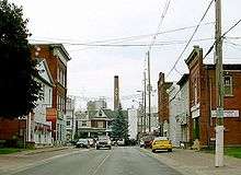
The township administrative offices are located in Winchester.
Village of Chesterville
In 1825, two men by the name of Merkley made plans to build a mill, but while returning from Waddington with their supplies, both men drowned after their canoe upset. In the early 1830s, Thomas Armstrong and his son John, both of Edwardsburg, erected a saw mill on the site where the previous mill was supposed to be built. The site was a prime location because it was situated on the Nation River, a major transportation route at the time.[2] After John's death from cholera, Thomas took over and soon had a grist mill in operation as well, and by 1838, these two mills had attracted many settlers to the area. It was because of Thomas and John Armstrong that the area gained the name Armstrong's Mills. In 1845, a post office was erected and the area became known as Winchester. In 1848, the Province of Ontario was divided up into townships, and in 1850, the first Chamber of Council was established in the area. There was much confusion due to their being a Winchester, West Winchester, and North Winchester, so in 1875, Winchester was changed to Chesterville, after Chester T. Casselman, a telegraph operator in the area who eventually became the postmaster.[3] In 1890, Chesterville was incorporated as a village.[4]
Village of Winchester
The village was originally settled by Ben Bates in 1835 and was first called Bates Corners. During the early years residents traveled to Winchester (Chesterville) for supplies and to pick up their mail they went to Matilda (Iroquois). The Morewood area had swamp like conditions which drew the Irish and Scottish settlers, as water has always been crucial for survival and development. The early Irish settlers in the Ormond area used the Castor River as means of transportation. Business started to evolve and by 1855, Winchester had a general store, blacksmith shop, a carriage maker and a farm produce business. Also in 1855, the first post office was opened and with this the name of Bates Corners was changed to West Winchester. In 1884 with the establishment of the Canadian Pacific Railway, West Winchester became Winchester. Winchester enjoyed years of growth and, in January 1888, was incorporated as a village and an independent township.[5]
Winchester District Memorial Hospital (WDMH) is located in the Village of Winchester. The hospital recently underwent a $60 million redevelopment. This significant redevelopment included the construction of a new wing, redevelopment of emergency services, acute care, obstetrical inpatient services, day surgery and a state of the art diagnostic imaging unit including a new CT Scanner and digital mammography.
It is a rural teaching hospital affiliated with 14 universities and colleges, including the University of Ottawa and St. Paul's University. It is networked with all hospitals and community agencies in the Champlain LHIN.
It is supported by 150 physicians in the fields of anaesthesia, cardiology, dentistry, diagnostic Imaging, emergency medicine, family medicine, general surgery, geriatrics, gynaecology, internal medicine, nephrology, ostetrics, ophthalmology, paediatrics, physical medicine, and urology.
Mountain Township
In 1798, it was named by John Graves Simcoe after Jacob Mountain, the first Anglican Bishop of Quebec, a personal friend. The township began to develop between 1868 and 1872, when two saw mills were erected by John Smirle and James Hyndman. The township had three post offices: in South Mountain (1851), Hallville (1873), and Mountain (1888). In September 1887, the first railroad track was opened and the station became a shipping station for cheese, livestock, milk, eggs and other farm produce.[6] The Tinkler's Oak Valley Farms are one of the many examples of great quality dairy out of the region.
Demographics
| Canada census – North Dundas, Ontario community profile | |||
|---|---|---|---|
| 2011 | 2006 | ||
| Population: | 11,225 (1.2% from 2006) | 11,095 (0.7% from 2001) | |
| Land area: | 503.21 km2 (194.29 sq mi) | 503.18 km2 (194.28 sq mi) | |
| Population density: | 22.3/km2 (58/sq mi) | 22.0/km2 (57/sq mi) | |
| Median age: | 40.6 (M: 40.2, F: 40.9) | ||
| Total private dwellings: | 4518 | 4323 | |
| Median household income: | $55,719 | ||
| References: 2011[7] 2006[8] earlier[9] | |||
Events
There are a number of major summer fairs and festivals that take place in the Township of North Dundas. Every summer, Chesterville holds a summer agricultural fair. The Village of Winchester hosts "Dairyfest" in early August and the Village of South Mountain hosts their summer agricultural fair also in August.
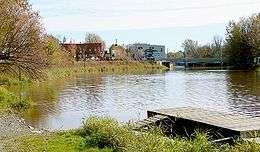
The Village of Chesterville hosts the 'Chesterville Farmer's Market' on the waterfront every Saturday during the summer months, and an annual 'Art on the Waterfront' in June.
Notable people
- Larry Robinson, Stanley Cup winner and Hockey Hall of Fame member, was born in Winchester in 1951.
- George Beverly "Bev" Shea (1909-2013) was born on February 1, 1909, in Winchester. He is a Grammy Award-winning gospel singer and hymn composer. Shea has often been described as "America's beloved Gospel singer" and is considered "the first international singing 'star' of the gospel world" as a consequence of his solos at Billy Graham Crusades and his exposure on radio, records, and television. According to the Guinness Book of Records Shea holds the world record for singing in person to the most people ever, with an estimated cumulative live audience of 220 million people.
- Dewey Martin of the rock band Buffalo Springfield was born in Chesterville in 1940.
- Matt Carkner, a professional hockey player who scored one of the greatest goals in Ottawa Senators history, a triple overtime winner in the 2010 playoffs vs the Pittsburgh Penguins, has played for the NHL's Ottawa Senators, San Jose Sharks and New York Islanders; he is now with the AHL's Bridgeport Sound Tigers
- Slater Koekkoek, who grew up in the Township and was born in Winchester, Ontario, was selected 10th overall by Tampa Bay Lightning during the 2012 NHL Entry Draft. He currently plays for the Syracuse Crunch and made his NHL debut on March 31, 2015 against the Toronto Maple Leafs.
See also
References
- 1 2 "North Dundas census profile". 2011 Census of Population. Statistics Canada. Retrieved 2012-02-27.
- ↑ Carter, J. Smyth, The Story of Dundas Being a History of the County of Dundas from 1784 to 1904. The St. Lawrence Publishing House, Iroquois: 1905, pgs. 383-388.
- ↑ Carter, J. Smyth, The Story of Dundas Being a History of the County of Dundas from 1784 to 1904. The St. Lawrence Publishing House, Iroquois: 1905, pgs. 388-392.
- ↑ "Chesterville". The Canadian Encyclopedia.
- ↑ Carter, J Smyth (1905). The Story of Dundas Being a History of the County of Dundas from 1784 to 1904. Iroquois: The St. Lawrence Publishing House. pp. 374–78.
- ↑ Carter, J Smyth (1905). The Story of Dundas Being a History of the County of Dundas from 1784 to 1904. Iroquois: The St. Lawrence Publishing House. pp. 227–38.
- ↑ "2011 Community Profiles". Canada 2011 Census. Statistics Canada. July 5, 2013. Retrieved 2012-02-27.
- ↑ "2006 Community Profiles". Canada 2006 Census. Statistics Canada. March 30, 2011. Retrieved 2012-02-27.
- ↑ "2001 Community Profiles". Canada 2001 Census. Statistics Canada. February 17, 2012.
External links
| Wikimedia Commons has media related to North Dundas, Ontario. |
Places adjacent to North Dundas, Ontario | |
|---|---|