Norman Island (Victoria)
 Norman Island | |
| Etymology | William Henry Norman[1] |
|---|---|
| Geography | |
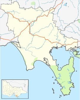
| Location | Wilsons Promontory |
| Coordinates | 39°01′17″S 146°14′29″E / 39.02125°S 146.24125°ECoordinates: 39°01′17″S 146°14′29″E / 39.02125°S 146.24125°E |
| Area | 48 ha (120 acres)[2] |
| Length | 1,400 m (4,600 ft)[2] |
| Width | 650 km (404 mi)[2] |
| Highest elevation | 96 m (315 ft)[2] |
| Administration | |
|
Australia | |
| State | Victoria |
Norman Island, an oceanic island, is located approximately 4 kilometres (2.5 mi) west of Picnic Point, Wilsons Promontory in Victoria, Australia.[2]
The island, to the mean low-water mark, is part of the Wilsons Promontory National Park and is proclaimed as a Remote and Natural Area under the National Parks Act. The surrounding waters to a distance of 300 m from the mean low-water mark are part of Wilsons Promontory Marine Park.[3]:1 The island is part of the Wilsons Promontory Islands Important Bird Area, identified as such by BirdLife International because of its importance for breeding seabirds.[4]
The island is named after Captain William Henry Norman, who brought Sir Charles Hotham to Melbourne in Queen of the South in 1854, and later served as commander of HMVS Victoria.[1]
References
- 1 2 Bird, Eric (12 October 2006). "Place Names on the Coast of Victoria" (PDF). The Australian National Placename Survey (ANPS). Archived from the original (PDF) on 10 February 2011.
- 1 2 3 4 5 Norman, F. I.; Brown, R. S.; Deerson, D. M. (November 1980). "Seabird islands No 95, Norman Island, Wilsons Promontory, Victoria" (PDF). Corella. 4 (4): 96–97.
- ↑ Parks Victoria (2006), Wilsons Promontory Marine National Park and Wilsons Promontory Marine Park Management Plan (PDF), ISBN 0731183460
- ↑ "Important Bird Areas factsheet: Corner Inlet". BirdLife International. 2017.
Islands of Victoria, Australia | |||||||||||
|---|---|---|---|---|---|---|---|---|---|---|---|
| Islands off East Gippsland | |||||||||||
| Islands within Corner Inlet |
| ||||||||||
| Islands off Wilsons Promontory |
| ||||||||||
| Islands within Western Port | |||||||||||
| Islands within Port Phillip | |||||||||||
| Islands within Bass Strait and the Great Australian Bight | |||||||||||
| River islands | |||||||||||
| |||||||||||