Nishitōkyō, Tokyo
| Nishitōkyō 西東京市 | |||
|---|---|---|---|
| City | |||
| Nishitokyo | |||
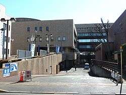 Nishitōkyō City Hall | |||
| |||
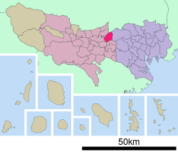 Location of Nishitōkyō in Tokyo | |||
 Nishitōkyō | |||
| Coordinates: 35°43′32.2″N 139°32′17.7″E / 35.725611°N 139.538250°ECoordinates: 35°43′32.2″N 139°32′17.7″E / 35.725611°N 139.538250°E | |||
| Country | Japan | ||
| Region | Kantō | ||
| Prefecture | Tokyo | ||
| Area | |||
| • Total | 15.75 km2 (6.08 sq mi) | ||
| Population (February 2016) | |||
| • Total | 200,102 | ||
| • Density | 12,700/km2 (33,000/sq mi) | ||
| Time zone | UTC+9 (Japan Standard Time) | ||
| Symbols | |||
| • Tree | Zelkova serrata & Cornus florida | ||
| • Flower | Azalea, Sunflower, Cosmos, Narcissus | ||
| Phone number | 042-464-1311 | ||
| Address | 5-6-13 Minami-machi, Nishitōkyō-shi, Tokyo 188-8666 | ||
| Website |
www | ||


Nishitōkyō (西東京市 Nishitōkyō-shi)/Japanese pronunciation: [niʃitɔ̞ːcœː] is a city located in the western portion of Tokyo Metropolis, Japan. As of 1 February 2016, the city had an estimated population of 200,102, and a population density of 12,700 persons per km². Its total area is 15.75 square kilometres (6.08 sq mi).
Geography
Nishitokyo is located at the centre of the geological/geographical region known as the Musashino Terrace, and is covered with the Kantō loam formation. The city has a good water supply, owing to rivers running through the city - the Shakujii River, Shirako River, Shin River (tributary of Shirako River) and Tamagawa Josui River. From east to west, the city is about 4.8 km, and from south to north is about 5.6 km.
Neighborhoods
- former city of Hoya
- Fuji-machi, Hibarigaoka, Higashi-cho, Higashi-fushimi, Hoya-cho, Izumi-cho, Kita-machi, Naka-machi, Sakae-cho, Shimo-hoya, Shin-machi, Sumiyoshi-cho, Yagisawa
- former city of Tanashi
- Kitahara-cho, Midori-cho, Minami-cho, Mukodai-cho, Nishihara-cho, Shibakubo-cho, Tanashi-cho, Yato-cho
Surrounding municipalities
- Tokyo Metropolis
- Nerima-ku (to the east)
- Kodaira (to the west)
- Koganei (to the south)
- Musashino (to the south)
- Higashikurume (to the northwest)
- Saitama Prefecture
History
The area of present-day Nishitōkyō was part of ancient Musashi Province. In the post-Meiji Restoration cadastral reform of July 22, 1878, the area became part of Kitadachi District in Saitama Prefecture. The villages of Hoya and Tanashi were created on April 1, 1889 with the establishment of municipalities law. The southern portion of Kitaadachi District was transferred to the administrative control of Tokyo Metropolis on April 1, 1907.
The modern city of Nishitōkyō was established on January 21, 2001. Before that date, the area was two separate cities Hoya and Tanashi. The name Nishitōkyō means "West Tokyo."
Economy
The watch manufacturer, Citizen is headquartered in Nishitōkyō. The animation studio Shin-Ei Animation is also located here.
Education
Universities and colleges
- Musashino University
- Waseda University - Higashi-Fushimi campus
- Tokyo University - Tanashi campus
Primary and secondary education
- Nishitōkyō has 19 public elementary schools and nine public middle schools operated by the city government and one private combined middle/high school.
- The city has three public high schools operated by the Tokyo Metropolitan Government Board of Education and three private high schools, including Musashino Joshi Gakuin.
Transportation
Railway
Highway
- Nishitōkyō is not served by any national expressways or national highways
External links
| Wikivoyage has a travel guide for Nishitokyo. |
| Wikimedia Commons has media related to Nishitokyo, Tokyo. |
- Nishitōkyō City Official Website (in Japanese)
| Special Wards of Tokyo | |||||||
|---|---|---|---|---|---|---|---|
| Western (Tama area) |
| ||||||
| Subprefectures | |||||||
| |||||||