Ngoma, Uganda
| Ngoma | |
|---|---|
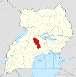
 Ngoma Map of Uganda showing the location of Ngoma | |
| Coordinates: 01°10′48″N 32°01′05″E / 1.18000°N 32.01806°E | |
| Country |
|
| Region | Central Uganda |
| District | Nakaseke District |
| Constituency | Nakaseke North |
| Government | |
| • Member of Parliament | Syda Bbumba |
| Population (2014 census) | |
| • Total | 6,295[1] |
| Time zone | UTC+3 (EAT) |
Ngoma is a small town in Nakaseke District, Central Uganda. It is one of the municipalities within Nakaseke District.[2] Other municipalities in the district include: (a) Butalangu (b) Kapeeka (c) Nakaseke (d) Semuto and (e) Wakyaato.
Location
Ngoma is located approximately 83 kilometres (52 mi), by road, northwest of Luweero, the largest town in the sub-region.[3] It lies about 16 kilometres (9.9 mi), by road, north of Nakaseke, where the district headquarters are located.[4] This location is approximately 132 kilometres (82 mi), by road, northwest of Kampala, Uganda's capital and largest city.[5] The coordinates of the town are:1°10'50.0"N 32°01'03.0"E (Latitude:1.180551; Longitude:32.017491).[6]
Population
During the national census and household survey of August 2014, the Uganda Bureau of Statistics (UBOS), enumerated the population of Ngoma at 6,295 people.[1]
Landmarks
The landmarks within the town limits or near the town include: (a) The offices of Ngoma Town Council (b) Ngoma Health Centre IV (c) Ngoma Central Market and (d) Oliver Tambo School of Leadership - Located at Kaweweta, near Ngoma.[7][8]
See also
References
- 1 2 UBOS (November 2014). "National Population and Housing Census 2014: Provisional Results: Appendix 3 - Households and Population by Subcounty/ Town Council/Urban Division and Sex, 2014" (PDF). Kampala: Uganda Bureau of Statistics (UBOS). Retrieved 2 August 2017.
- ↑ Cyprian Musoke, and Joyce Namutebi (1 September 2009). "MPS warn on new town councils". New Vision. Kampala. Archived from the original on 4 September 2009. Retrieved 18 December 2015.
- ↑ GFC (18 December 2015). "Road Distance Between Luweero and Ngoma with Map". Globefeed.com. Retrieved 18 December 2015.
- ↑ GFC (18 December 2015). "Map Showing Nakaseke And Ngoma With Route Marker". Globefeed.com (GFC). Retrieved 18 December 2015.
- ↑ GFC (18 December 2015). "Road Distance Between Kampala And Ngoma With Map". Globefeed.com. Retrieved 18 December 2015.
- ↑ Google (18 December 2015). "Location of Ngoma, Uganda At Google Maps" (Map). Google Maps. Google. Retrieved 18 December 2015.
- ↑ Kabushenga, Robert (2015). "Uganda's role in liberating South Africa". New Vision Mobile. Kampala. Archived from the original on 22 December 2015. Retrieved 18 December 2015.
- ↑ Mugisa, Anne (27 March 2010). "Zuma Opens Tambo Leadership School". New Vision. Kampala. Archived from the original on 24 February 2015. Retrieved 18 December 2015.
External links
Capital: Butalangu | ||
| Counties and sub-counties |
|  |
| Towns and villages | ||
| Health | ||
| Notable landmarks |
| |
| Transport | ||
| Education |
| |
| Notable people | ||