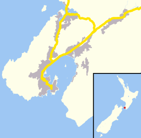
Newlands, New Zealand
| Newlands | |
|---|---|
 Newlands | |
| Basic information | |
| Local authority | Wellington City |
| Electoral ward | Northern Ward |
| Land area | 682 ha (2.63 sq mi)[1] |
| Coordinates | 41°13′26″S 174°49′23″E / 41.224°S 174.823°ECoordinates: 41°13′26″S 174°49′23″E / 41.224°S 174.823°E |
| Population | 7,278[1] (2013) |
| Postcode(s) | 6037 |
| Surrounds | |
| North | Paparangi, Woodridge, Grenada |
| Northeast | Horokiwi |
| East | Wellington Harbour |
| South | Ngauranga |
| West | Johnsonville |
Newlands is one of the northern suburbs of Wellington, New Zealand. It lies approximately 8 km north of the city centre and to the east of its nearest neighbour Johnsonville. It has a long history of early settlement and originally was farmed including being the early source of Wellington's milk. Newlands is located in a valley and covers two ridgelines, the side of one of which overlooks Wellington Harbour and up to the Hutt Valley.
History
The area that modern Newlands occupies was originally known as Papararangi[2] which is Te Reo Māori for "cluster of hills".[3] A 40 ha area was sold during the 1840-41 land ballots run by the New Zealand Company.[4] There are two theories to the suburb's name. The first is that it was named after Thomas Newland[4] who arrived in New Zealand from London in 1875 aboard the ship “Avalanche” and ran a business making glue and oil in neighboring Johnsonville before becoming Manager of the Manure Department of the Wellington Meat Export Company's Works in 1892.[5] Thomas Newland was close friends of Walter Futter who owned land in Newlands.[4] The second theory is that it was simply the "New Land" near Johnsonville.[2]
The area was mostly used as a pig and dairy farm, providing Wellington most of their town milk supply from the 1920s to the 1950s.[2] Dairy farms were run by Bill Miles of Newlands Dairy Limited who purchased James Purchase’s farm in Glanmire Rd and ran 100 cows, also Pearce and Tristram. After the Second World War Miles subdivided for housing; initially in Wakely Road, then in Miles Crescent, Lyndfield Lane, Black Rock Road and Glanmire Road. Ernest Hoskings grazed his dairy herd in Johnsonville, Newlands and Horokiwi. [6] [7]
Newlands was the location of the 1923 "Newlands Baby Farmers", where Daniel Cooper was found guilty and executed for murder, performing illegal abortions and baby farming.[8]
Facilities
Newlands has recently (2013) had a revamped shopping centre with a new supermarket, and a new community centre. It is close to services and a mall located in its near neighbour Johnsonville.
Community Centre
The Newlands Community Centre was opened in 2009[9] and is home to a drop in centre, Newlands Toy Library[10] and many community groups.
Volunteer Fire Brigade
Newlands Volunteer Fire Brigade was established in 1965 on Newlands Road and has 22 members and one appliance; a 2010 Iveco Eurocargo 6/1 light pumping appliance.[11]
Parks and reserves
Newlands has a number of parks and reserves, including:
Transport
Newlands has good access to Wellington's CBD and to Lower Hutt by a road connection to Ngauranga Gorge; and to Johnsonville and the main motorway to Kapiti and north via Stewart Drive, constructed in the 1960s.[16]
Newlands is served by buses to and from the city, run by Newlands Coach Services. Some run via the Johnsonville Hub.
Education
School enrollment zones
Newlands is within the enrollment zones for Newlands College, Newlands School and St Oran's College.[17]
Secondary education
Newlands College is a state coeducational secondary school located on Bracken Road in Newlands.
Primary and intermediate education
Newlands has three primary schools and one intermediate school:
- Newlands Intermediate is intermediate school located on Bracken road, next to Newlands College. It is a decile 9[18] school with a roll of 313 in 2014.[18]
- Newlands School is a contributing primary school located on Newlands Road. It is a decile 8[19] school with a roll of 337 in 2014.[18]
- Rewa Rewa School is a contributing primary school located on Padnell Crescent. It is a decile 9[20] school with a roll of 71 in 2014.[18]
- Bellevue School is a contributing primary school located on Bancroft Terrace. It is a decile 8[21] school with a roll of 266 in 2014.[18]
References
- 1 2 "Community Profile: Newlands".
- 1 2 3 "Newlands - a bit of history".
- ↑ "Maori Language Week - 1000 Māori place names".
- 1 2 3 "Newlands Rd's shady past".
- ↑ "The Cyclopedia of New Zealand - Mr. Thomas Newland".
- ↑ Robertson, Lawson & Louise (2012). Up in the Breezy Hills: The History of the suburb Newlands-Paparangi. Wellington: Robertson. pp. 104, 105. ISBN 978-1-877572-48-7.
- ↑ Bremner, Julie (1987). Wellington’s Northern Suburbs 1919-1945. Wellington: Millwood Press. pp. 95, 98. ISBN 0-908582-80-3.
- ↑ "The Newlands baby farmers".
- ↑ "Newlands Community Centre".
- ↑ "Newlands Toy Library".
- ↑ "Newlands Volunteer Fire Brigade".
- 1 2 3 4 5 6 7 "Play parks and sports grounds". Archived from the original on 2015-02-19.
- ↑ "Seton Nossiter Park".
- ↑ "Waihinahina Park".
- ↑ "Gilberd Bush Reserve".
- ↑ Meyer, R J (Bob) (1990). Up in the Hills: a history of Johnsonville. Wellington: Northern Suburbs Community Newspaper Trust. p. 76. ISBN 0-473-00925-0.
- ↑ "eLearning Schools Search".
- 1 2 3 4 5 "Ministry of Education School Rolls".
- ↑ "Newlands School - Our School".
- ↑ "Rewa Rewa School". Archived from the original on 2015-02-19.
- ↑ "Bellevue School". Archived from the original on 2015-02-19.