Neuhütten, Rhineland-Palatinate
| Neuhütten | ||
|---|---|---|
| ||
 Neuhütten Location of Neuhütten within Trier-Saarburg district 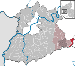 | ||
| Coordinates: 49°38′40″N 7°00′59″E / 49.64435°N 7.01643°ECoordinates: 49°38′40″N 7°00′59″E / 49.64435°N 7.01643°E | ||
| Country | Germany | |
| State | Rhineland-Palatinate | |
| District | Trier-Saarburg | |
| Municipal assoc. | Hermeskeil | |
| Government | ||
| • Mayor | Peter Kretz | |
| Area | ||
| • Total | 10.50 km2 (4.05 sq mi) | |
| Elevation | 540 m (1,770 ft) | |
| Population (2017-12-31)[1] | ||
| • Total | 742 | |
| • Density | 71/km2 (180/sq mi) | |
| Time zone | CET/CEST (UTC+1/+2) | |
| Postal codes | 54422 | |
| Dialling codes | 06503 | |
| Vehicle registration | TR | |

Neuhütten is a municipality in the Trier-Saarburg district, in Rhineland-Palatinate, Germany.
Neuhütten is a very active village with many cultural activities. Although the village counts only around 808 inhabitants, you can find about 13 clubs and associations.
The following clubs are active in Neuhütten (Hochwald):
| Association/Club | Short description |
|---|---|
| AWO OV Züsch/Neuhütten | charitable society |
| FC Züsch/Neuhütten | soccer sports club |
| FÖV f. Kindergarten & Grundschule | education |
| Heimatverein Neuhütten | cultural club |
| Jugendclub Neuhütten | teenage club |
| Hüttenzauber Turngruppe | gym club |
| KUKI Kultur- und Karnevalsinitiative | carnival and cultural club |
| MGV "Germania" Neuhütten | men's sing club |
| MV Harmonie | music club |
| Ski-Club Dollberg | ski club |
| TC Könnigsbachtal | tennis club |
| Kegelsportclub | skittles club |
| . Frauengemeinschaft Züsch/Neuhütten | catholic women club |
Places of Interest:
Since 2015 is Neuhütten officially placed in the "Hochwald Nationalpark", therefore the surroundings and the forest is a very beautiful and peaceful place to be.
Further the ski cottage, which is opened whenever there is snow, is a nice location to visit as well as the old Forsthaus "Altes Forsthaus" with its horse ranch.
Recently there has been a news team at the Dollberg Neuhütten. You can watch the video at: http://www.ardmediathek.de/
Celebrities:
Klaus Mörsdorf 1909–1989), catholic theologian and canonist
Next exits to the highway:
Otzenhausen approx. 6 km
Hermeskeil approx. 10 km
Distance to bigger cities > 100.000 inhabitants:
Trier: approx. 44 km
Saarbrücken: approx. 56 km
Luxembourg: approx. 85 km
References
- ↑ Statistisches Landesamt Rheinland-Pfalz "Bevölkerungsstand 2017 - Gemeindeebene" Check
|url=value (help). Statistisches Landesamt Rheinland-Pfalz (in German). 2018.