Lampaden
| Lampaden | ||
|---|---|---|
| ||
 Lampaden Location of Lampaden within Trier-Saarburg district 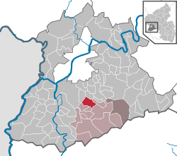 | ||
| Coordinates: 49°38′55″N 6°42′7″E / 49.64861°N 6.70194°ECoordinates: 49°38′55″N 6°42′7″E / 49.64861°N 6.70194°E | ||
| Country | Germany | |
| State | Rhineland-Palatinate | |
| District | Trier-Saarburg | |
| Municipal assoc. | Kell am See | |
| Government | ||
| • Mayor | Martin Marx (CDU) | |
| Area | ||
| • Total | 8.16 km2 (3.15 sq mi) | |
| Elevation | 420 m (1,380 ft) | |
| Population (2017-12-31)[1] | ||
| • Total | 566 | |
| • Density | 69/km2 (180/sq mi) | |
| Time zone | CET/CEST (UTC+1/+2) | |
| Postal codes | 54316 | |
| Dialling codes | 06588 | |
| Vehicle registration | TR | |
| Website | lampaden.de | |

Lampaden is a municipality in the Trier-Saarburg district, in Rhineland-Palatinate, Germany. The village is over a thousand years old and acquired grazing rights in the year 1036. The area was already populated in Celtic and Roman times.
During World War II, the only two operational V3 cannons used to bombard Luxembourg were installed in a wooded ravine of the Ruwer River at Lampaden about 13 kilometres (8.1 mi) southeast of Trier. The village was heavily damaged in early March 1945 during a German counterattack.
References
- ↑ Statistisches Landesamt Rheinland-Pfalz "Bevölkerungsstand 2017 - Gemeindeebene" Check
|url=value (help). Statistisches Landesamt Rheinland-Pfalz (in German). 2018.
This article is issued from
Wikipedia.
The text is licensed under Creative Commons - Attribution - Sharealike.
Additional terms may apply for the media files.