| [2] |
Name on the Register |
Image |
Date listed[3] |
Location |
City or town |
Description |
|---|
| 1 |
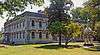
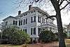
Academy of Richmond County |
|
April 11, 1973
(#73000639) |
540 Telfair St.
33°28′12″N 81°57′45″W / 33.47°N 81.9625°W / 33.47; -81.9625 (Academy of Richmond County) |
Augusta |
|
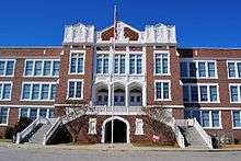
| 2 |
Academy of Richmond County-1926 Campus |
|
January 28, 2004
(#03001491) |
910 Russell St.
33°28′25″N 82°00′17″W / 33.473611°N 82.004722°W / 33.473611; -82.004722 (Academy of Richmond County-1926 Campus) |
Augusta |
|
| 3 |
Augusta Canal Industrial District |
|
May 27, 1971
(#71000285) |
Along the west bank of the Savannah River from the Richmond-Columbia county line to 10th and Fenwick Sts.
33°29′51″N 81°59′47″W / 33.4975°N 81.996389°W / 33.4975; -81.996389 (Augusta Canal Industrial District) |
Augusta |
National Historic Landmark (canal and historic district), extends into Columbia County |
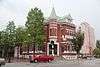
| 4 |
Augusta Cotton Exchange Building |
|
July 20, 1978
(#78001003) |
Reynolds St.
33°28′35″N 81°57′53″W / 33.476389°N 81.964722°W / 33.476389; -81.964722 (Augusta Cotton Exchange Building) |
Augusta |
|
| 5 |
Augusta Downtown Historic District |
|
June 11, 2004
(#04000515) |
Roughly bounded by 13th St., Gordon Hwy., Walton Way and the Savannah R.
33°28′18″N 81°57′50″W / 33.471667°N 81.963889°W / 33.471667; -81.963889 (Augusta Downtown Historic District) |
Augusta |
|
| 6 |
Bath Presbyterian Church and Cemetery |
|
October 27, 2004
(#04001179) |
Edie Bath Rd., 0.5 miles (0.80 km) west of US 1
33°20′11″N 82°10′22″W / 33.33641°N 82.1728°W / 33.33641; -82.1728 (Bath Presbyterian Church and Cemetery) |
Blythe |
|
| 7 |
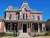
Stephen Vincent Benet House |
|
November 11, 1971
(#71000286) |
2500 Walton Way
33°28′33″N 82°01′27″W / 33.47580°N 82.02407°W / 33.47580; -82.02407 (Stephen Vincent Benet House) |
Augusta |
National Historic Landmark |
| 8 |
Bethlehem Historic District |
|
December 1, 1997
(#97001470) |
Roughly bounded by Wrightsboro Rd., MLK Jr. Blvd., Railroad, Poplar, and Clay Sts.
33°27′32″N 81°59′05″W / 33.458889°N 81.984722°W / 33.458889; -81.984722 (Bethlehem Historic District) |
Augusta |
|
| 9 |
Brahe House |
|
April 11, 1973
(#73000640) |
456 Telfair St.
33°28′09″N 81°57′37″W / 33.469167°N 81.960278°W / 33.469167; -81.960278 (Brahe House) |
Augusta |
|
| 10 |
Broad Street Historic District |
|
April 28, 1980
(#80001226) |
Broad St. between 5th and 13th Sts.
33°28′30″N 81°58′02″W / 33.475°N 81.967222°W / 33.475; -81.967222 (Broad Street Historic District) |
Augusta |
|
| 11 |
Cauley-Wheeler Memorial Building |
|
June 4, 2008
(#08000493) |
1339 Laney Walker Blvd.
33°28′01″N 81°58′58″W / 33.46698°N 81.98274°W / 33.46698; -81.98274 (Cauley-Wheeler Memorial Building) |
Augusta |
Demolished in 2011[4][5] |
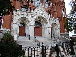
| 12 |
Church of the Most Holy Trinity |
|
March 21, 1997
(#97000250) |
720 Telfair St.
33°28′18″N 81°58′01″W / 33.471667°N 81.966944°W / 33.471667; -81.966944 (Church of the Most Holy Trinity) |
Augusta |
|
| 13 |
College Hill |
|
November 11, 1971
(#71000287) |
2216 Wrightsboro Rd.
33°28′00″N 82°00′49″W / 33.466667°N 82.013611°W / 33.466667; -82.013611 (College Hill) |
Augusta |
National Historic Landmark |
| 14 |
Joseph Darling House |
|
April 18, 1991
(#91000479) |
3066 Dennis Rd.
33°31′41″N 82°02′55″W / 33.528°N 82.04871°W / 33.528; -82.04871 (Joseph Darling House) |
Martinez |
|
| 15 |
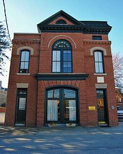
Engine Company Number One |
|
May 25, 1988
(#88000565) |
452 Ellis St.
33°28′17″N 81°57′34″W / 33.471389°N 81.959444°W / 33.471389; -81.959444 (Engine Company Number One) |
Augusta |
|
| 16 |
First Baptist Church of Augusta |
|
March 23, 1972
(#72000397) |
Greene and 8th Sts.
33°28′21″N 81°58′03″W / 33.4725°N 81.9675°W / 33.4725; -81.9675 (First Baptist Church of Augusta) |
Augusta |
|
| 17 |
First Presbyterian Church of Augusta |
|
February 21, 1997
(#97000100) |
642 Telfair St.
33°28′13″N 81°57′54″W / 33.470278°N 81.965°W / 33.470278; -81.965 (First Presbyterian Church of Augusta) |
Augusta |
|
| 18 |
FitzSimons-Hampton House |
|
October 29, 1976
(#76000645) |
SR 28
33°26′59″N 81°55′17″W / 33.449722°N 81.921389°W / 33.449722; -81.921389 (FitzSimons-Hampton House) |
Augusta |
|
| 19 |
Fruitlands |
|
May 25, 1979
(#79000742) |
2604 Washington Rd.
33°30′03″N 82°01′20″W / 33.500833°N 82.022222°W / 33.500833; -82.022222 (Fruitlands) |
Augusta |
Clubhouse of the Augusta National Golf Club - admission only to members and ticket holders to tournaments[6] |
| 20 |
Gertrude Herbert Art Institute |
|
March 20, 1973
(#73000641) |
506 Telfair St.
33°28′11″N 81°57′41″W / 33.469722°N 81.961389°W / 33.469722; -81.961389 (Gertrude Herbert Art Institute) |
Augusta |
|
| 21 |
Gould-Weed House |
|
July 16, 1979
(#79000743) |
828 Milledge Rd.
33°28′35″N 82°00′46″W / 33.476389°N 82.012778°W / 33.476389; -82.012778 (Gould-Weed House) |
Augusta |
|
| 22 |
Greene Street Historic District |
|
December 3, 1980
(#80001227) |
Greene St.
33°28′25″N 81°58′05″W / 33.473611°N 81.968056°W / 33.473611; -81.968056 (Greene Street Historic District) |
Augusta |
|
| 23 |
Harris-Pearson-Walker House |
|
October 28, 1969
(#69000052) |
1822 Broad St.
33°29′04″N 81°59′42″W / 33.484444°N 81.995°W / 33.484444; -81.995 (Harris-Pearson-Walker House) |
Augusta |
|
| 24 |
Harrisburg-West End Historic District |
|
June 7, 1990
(#90000802) |
Roughly bounded by 15th St., Walton Way, Heard Ave., Milledge Rd., and the Augusta Canal
33°28′55″N 81°59′50″W / 33.481944°N 81.997222°W / 33.481944; -81.997222 (Harrisburg-West End Historic District) |
Augusta |
|
| 25 |
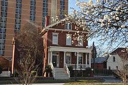
Dr. Asbury and Martha Hull House |
|
September 18, 2018
(#100002961) |
2749 Hillcrest Ave.
33°28′40″N 82°01′59″W / 33.4777°N 82.0330°W / 33.4777; -82.0330 (Dr. Asbury and Martha Hull House) |
Augusta |
|
| 26 |
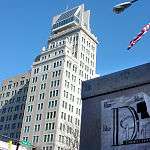
Lamar Building |
|
April 24, 1979
(#79000744) |
753 Broad St.
33°28′31″N 81°57′54″W / 33.475278°N 81.965°W / 33.475278; -81.965 (Lamar Building) |
Augusta |
|
| 27 |
Joseph Rucker Lamar Boyhood Home |
|
June 13, 1996
(#96000598) |
415 7th St.
33°28′19″N 81°57′55″W / 33.471944°N 81.965278°W / 33.471944; -81.965278 (Joseph Rucker Lamar Boyhood Home) |
Augusta |
|
| 28 |
Laney-Walker North Historic District |
|
September 5, 1985
(#85001976) |
Bounded by D'Antignac, 7th, Twiggs, Phillips and Harrison Sts., Walton Way and Laney Walker Blvd.
33°28′01″N 81°58′29″W / 33.466944°N 81.974722°W / 33.466944; -81.974722 (Laney-Walker North Historic District) |
Augusta |
|
| 29 |
Liberty Methodist Church |
|
November 7, 1997
(#97001330) |
2040 Liberty Church Rd.
33°19′12″N 82°02′17″W / 33.32°N 82.038056°W / 33.32; -82.038056 (Liberty Methodist Church) |
Hephzibah |
|
| 30 |
Meadow Garden |
|
July 19, 1976
(#76000646) |
1230 Nelson St.
33°28′26″N 81°58′47″W / 33.47376°N 81.97979°W / 33.47376; -81.97979 (Meadow Garden) |
Augusta |
Home of George Walton, youngest signer of the U.S. Declaration of Independence, a National Historic Landmark |
| 31 |
Old Medical College Building |
|
March 16, 1972
(#72000398) |
Telfair and 6th Sts.
33°28′13″N 81°57′47″W / 33.470278°N 81.963056°W / 33.470278; -81.963056 (Old Medical College Building) |
Augusta |
National Historic Landmark |
| 32 |
Old Richmond County Courthouse |
|
December 22, 1978
(#78001004) |
432 Telfair St.
33°28′09″N 81°57′34″W / 33.469167°N 81.959444°W / 33.469167; -81.959444 (Old Richmond County Courthouse) |
Augusta |
|
| 33 |
Paine College Historic District |
|
December 26, 2012
(#12001082) |
1235 15th St.
33°28′10″N 81°59′35″W / 33.46954°N 81.993155°W / 33.46954; -81.993155 (Paine College Historic District) |
Augusta |
[7] |
| 34 |
Pinched Gut Historic District |
|
March 6, 1980
(#80001228) |
Roughly bounded by Gordon Hwy., E. Boundary, Reynolds, and Gwinnett Sts.
33°27′47″N 81°57′22″W / 33.463056°N 81.956111°W / 33.463056; -81.956111 (Pinched Gut Historic District) |
Augusta |
|
| 35 |
Reid-Jones-Carpenter House |
|
November 13, 1979
(#79000745) |
2249 Walton Way
33°28′41″N 82°00′56″W / 33.478056°N 82.015556°W / 33.478056; -82.015556 (Reid-Jones-Carpenter House) |
Augusta |
|
| 36 |
Sacred Heart Catholic Church |
|
March 16, 1972
(#72000399) |
Greene and 13th Sts.
33°28′38″N 81°58′37″W / 33.477222°N 81.976944°W / 33.477222; -81.976944 (Sacred Heart Catholic Church) |
Augusta |
|
| 37 |
Sands Hill Historic District |
|
July 9, 1997
(#97000754) |
Roughly bounded by Monte Sano and North View Aves., Mount Auburn St., Johns Rd., and Augusta Country Club.
33°29′00″N 82°01′13″W / 33.483333°N 82.020278°W / 33.483333; -82.020278 (Sands Hill Historic District) |
Augusta |
|
| 38 |
Seclusaval and Windsor Spring |
|
October 11, 1988
(#87001331) |
Junction of Windsor Spring and Tobacco Rds.
33°23′05″N 82°04′21″W / 33.384722°N 82.0725°W / 33.384722; -82.0725 (Seclusaval and Windsor Spring) |
Hephzibah |
|
| 39 |
Shiloh Orphanage |
|
December 30, 1996
(#96001500) |
1635 15th St.
33°27′32″N 81°59′55″W / 33.458889°N 81.998611°W / 33.458889; -81.998611 (Shiloh Orphanage) |
Augusta |
|
| 40 |
Springfield Baptist Church |
|
June 17, 1982
(#82002461) |
112 12th St. (original) and 114 12th St. (increase)
33°28′43″N 81°58′18″W / 33.478611°N 81.971667°W / 33.478611; -81.971667 (Springfield Baptist Church) |
Augusta |
There was a boundary increase on July 5, 1990 (refnum 90000979) |
| 41 |
St. Paul's Episcopal Church |
|
April 11, 1973
(#73000642) |
6th and Reynolds Sts.
33°28′33″N 81°57′42″W / 33.475833°N 81.961667°W / 33.475833; -81.961667 (St. Paul's Episcopal Church) |
Augusta |
|
| 42 |
Summerville Historic District |
|
May 22, 1980
(#80001229) |
Roughly bounded by Milledge Lane, Wrightsboro Rd., Highland and Heard Aves., Cumming and Henry Sts.
33°28′32″N 82°01′07″W / 33.475556°N 82.018611°W / 33.475556; -82.018611 (Summerville Historic District) |
Augusta |
|
| 43 |
Tubman High School |
|
March 7, 1994
(#94000154) |
1740 Walton Way
33°28′25″N 81°59′51″W / 33.473611°N 81.9975°W / 33.473611; -81.9975 (Tubman High School) |
Augusta |
|
| 44 |
United States Post Office and Courthouse |
|
January 21, 2000
(#99001648) |
500 E. Ford St.
33°28′20″N 81°58′03″W / 33.472222°N 81.9675°W / 33.472222; -81.9675 (United States Post Office and Courthouse) |
Augusta |
|
| 45 |
Woodrow Wilson Boyhood Home |
|
February 28, 1979
(#79000746) |
419 7th St.
33°28′18″N 81°57′54″W / 33.47167°N 81.96505°W / 33.47167; -81.96505 (Woodrow Wilson Boyhood Home) |
Augusta |
National Historic Landmark |
.jpg)
.jpg)
.jpg)
_May_2017.jpg)
.JPG)
%2C_Augusta%2C_Richmond_County%2C_GA_HABS_GA-2370-1.tif.jpg)
.jpg)
.JPG)
.jpg)
.JPG)
%2C_605_Reynolds_Street%2C_Augusta_(Richmond_County%2C_Georgia).jpg)
.jpg)
.jpg)
.jpg)