| [2] |
Name on the Register |
Image |
Date listed[3] |
Location |
City or town |
Description |
|---|
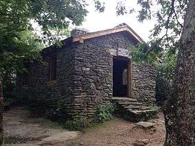
| 1 |
Blood Mountain Trail Shelter |
|
January 9, 2013
(#12001145) |
Blood Mountain Wilderness Area
34°44′25″N 83°56′15″W / 34.740272°N 83.937364°W / 34.740272; -83.937364 (Blood Mountain Trail Shelter) |
Blairsville |
|
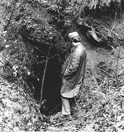
| 2 |
Calhoun Mine |
|
November 7, 1973
(#73002292) |
3 miles (4.8 km) south of Dahlonega off GA 60
34°33′43″N 83°59′09″W / 34.561944°N 83.985833°W / 34.561944; -83.985833 (Calhoun Mine) |
Dahlonega |
National Historic Landmark |
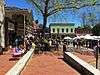
| 3 |
Dahlonega Commercial Historic District |
|
April 7, 1983
(#83000235) |
Chestates, Park, and Main Sts.
34°31′57″N 83°59′05″W / 34.5325°N 83.984722°W / 34.5325; -83.984722 (Dahlonega Commercial Historic District) |
Dahlonega |
|
| 4 |
Dahlonega Consolidated Gold Mine |
|
February 27, 1980
(#80001111) |
Northeast of Dahlonega
34°32′18″N 83°58′12″W / 34.538333°N 83.97°W / 34.538333; -83.97 (Dahlonega Consolidated Gold Mine) |
Dahlonega |
|
| 5 |
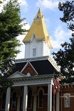
Dahlonega Courthouse Gold Museum |
|
August 26, 1971
(#71001100) |
U.S. 19
34°31′57″N 83°59′06″W / 34.5325°N 83.985°W / 34.5325; -83.985 (Dahlonega Courthouse Gold Museum) |
Dahlonega |
A Georgia state historic site |
| 6 |
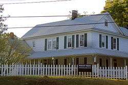
Daniel M. Davis House |
|
March 12, 1998
(#98000227) |
GA 9, 1.5 miles (2.4 km) southwest of the junction with GA 52
34°30′49″N 84°03′51″W / 34.513611°N 84.064167°W / 34.513611; -84.064167 (Daniel M. Davis House) |
Dahlonega |
|
| 7 |
Fields Place-Vickery House |
|
December 14, 1978
(#78000994) |
W. Main St. and Vickery Dr.
34°31′49″N 83°59′17″W / 34.530278°N 83.988056°W / 34.530278; -83.988056 (Fields Place-Vickery House) |
Dahlonega |
|
| 8 |
Hawkins Street Historic District |
|
May 12, 1995
(#95000504) |
Roughly, Hawkins St. from Church St. to N. Meaders St., including adjacent parts of Water, N. Chestatee and N. Park Sts.
34°32′00″N 83°59′11″W / 34.533333°N 83.986389°W / 34.533333; -83.986389 (Hawkins Street Historic District) |
Dahlonega |
|
| 9 |
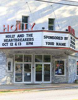
Holly Theatre |
|
February 21, 2002
(#02000080) |
69 W. Main St.
34°31′53″N 83°59′09″W / 34.531389°N 83.985833°W / 34.531389; -83.985833 (Holly Theatre) |
Dahlonega |
|
| 10 |
Lumpkin County Jail |
|
September 13, 1985
(#85002086) |
Clarksville St.
34°32′03″N 83°58′54″W / 34.53430°N 83.98160°W / 34.53430; -83.98160 (Lumpkin County Jail) |
Dahlonega |
|
| 11 |
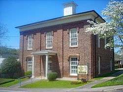
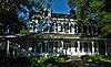
Price Memorial Hall |
|
January 20, 1972
(#72000387) |
College Ave.
34°31′47″N 83°59′13″W / 34.529722°N 83.986944°W / 34.529722; -83.986944 (Price Memorial Hall) |
Dahlonega |
|
| 12 |
Seven Oaks |
|
July 15, 1982
(#82002452) |
177 S. Park St.
34°31′51″N 83°58′56″W / 34.530833°N 83.982222°W / 34.530833; -83.982222 (Seven Oaks) |
Dahlonega |
|
.JPG)
.JPG)