National Register of Historic Places listings in Laurens County, Georgia
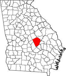
Location of Laurens County in Georgia
This is a list of properties and districts in Laurens County, Georgia that are listed on the National Register of Historic Places (NRHP).
- This National Park Service list is complete through NPS recent listings posted October 4, 2018.[1]
Current listings
| [2] | Name on the Register | Image | Date listed[3] | Location | City or town | Description |
|---|---|---|---|---|---|---|
| 1 | Carnegie Library | 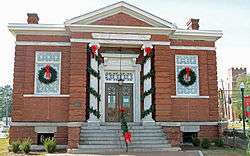 |
May 30, 1975 (#75000599) |
Jct. of Bellevue/Jackson and Academy Sts. (311 Academy Ave.) 32°32′19″N 82°54′30″W / 32.53864°N 82.90829°W |
Dublin | NRHP form incorrectly gives the location as 32°31'20"N, 82°54'28"W. Is a contributing property to the Dublin Commercial Historic District. |
| 2 | Dublin Commercial Historic District | 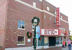 |
May 22, 2002 (#02000540) |
Roughly centered on Jackson Ave. and Lawrence St. 32°32′20″N 82°54′19″W / 32.538889°N 82.905278°W |
Dublin | |
| 3 | Fish Trap Cut | October 1, 1974 (#74000691) |
Address Restricted 32°28′15″N 82°51′28″W / 32.47072°N 82.85764°W |
Dublin | Fish Cut Mounds Fish Trap Cut | |
| 4 | Sanders Hill | May 28, 1975 (#75000600) |
S of Montrose off I-16/GA 404. 1.5 miles SW of Montrose, 5.5 miles W of Dudley. One acre surrounded by dirt road to the west and a fence around the rest (1975 NRHP form). 32°32′20″N 83°09′55″W / 32.538889°N 83.165278°W |
Montrose | ||
| 5 | Stubbs Park-Stonewall Street Historic District | 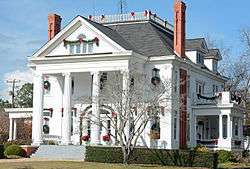 |
November 7, 2002 (#02001293) |
Roughly bounded by W. Moore St., Roosevelt St., Bellevue Ave., Marion St., Academy Ave., Lancaster and Thompson Sts. 32°32′07″N 82°54′59″W / 32.5352°N 82.9165°W |
Dublin | |
| 6 | United States Post Office and Court House | 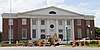 |
June 15, 2018 (#100002569) |
100 N Franklin St. 32°32′25″N 82°54′12″W / 32.5404°N 82.9032°W |
Dublin | Now the Federal Building and US Courthouse |
References
| Wikimedia Commons has media related to National Register of Historic Places in Laurens County, Georgia. |
- ↑ "National Register of Historic Places: Weekly List Actions". National Park Service, United States Department of the Interior. Retrieved on October 4, 2018.
- ↑ Numbers represent an ordering by significant words. Various colorings, defined here, differentiate National Historic Landmarks and historic districts from other NRHP buildings, structures, sites or objects.
- ↑ The eight-digit number below each date is the number assigned to each location in the National Register Information System database, which can be viewed by clicking the number.
| Topics | |
|---|---|
| Lists by states |
|
| Lists by insular areas | |
| Lists by associated states | |
| Other areas | |
| |
This article is issued from
Wikipedia.
The text is licensed under Creative Commons - Attribution - Sharealike.
Additional terms may apply for the media files.